Every system that can spoil a day at a Spanish beach has now been described on this site. Capacity barriers count cars. Blue Flags certify management. Municipal ordinances govern dogs. Lifeguard seasons determine whether anyone is watching. None of them measures the one variable that decides, more often than all of the others put together, whether the beach you drove to is pleasant or miserable.
Spanish coastal winds have names because they matter enough to have earned them. Learning the eight names on the local compass rose, and one simple principle about orientation, will improve your beach days more than any list of recommendations — including ours.
What This Guide Covers
- The principle, which is the whole article
- The names and directions
- Tramuntana, and the Empordà
- Levante and poniente in the Strait
- The Mediterranean winds on the eastern coast
- Choosing a beach by orientation
- Checking before you go
The Principle, Which Is the Whole Article
A wind is not good or bad. It is good or bad for a particular beach, and what determines which is the direction the shore faces.
Wind blowing off the land towards the sea flattens the water at the shore, holds the surface glassy, keeps the sand still and makes swimming comfortable. The same wind blowing onto the shore piles up chop, drives spray, lifts sand into your face and makes the water murky. It is the same air on the same afternoon. The difference is entirely which way the beach is pointing.
This is why “is it windy today?” is the wrong question, and “which direction is it coming from?” is the right one. On a coast with as many aspects as Spain’s, a strong wind almost always means that some beaches are unusable and others, an hour away, are at their best.
One practical warning before the names. Offshore wind flattens the water and it also pushes anything that floats — an inflatable, a paddleboard, a child on a lilo — steadily away from the shore, on a surface that looks deceptively calm. The most comfortable-looking water is not always the safest.
The Names and Directions
The compass rose used along the Spanish Mediterranean is older than the meteorological one and the names come mostly from sailors. Catalan and Spanish forms differ slightly; both are in use.
- Tramuntana — north. From transmontanus, “beyond the mountains”.
- Gregal — north-east. Cold and dry.
- Llevant / levante — east. From where the sun rises, or levanta.
- Xaloc / siroco / jaroque — south-east. Warm, often hazy.
- Migjorn / mediodía — south.
- Garbí / lebeche — south-west. Frequently arrives carrying Saharan sand and dust, which is why the sky turns that particular colour.
- Ponent / poniente — west. From where the sun sets.
- Mestral / mistral — north-west. The same wind Aragón calls the cierzo.
A confusion worth clearing up early: “Levante” is also the name of a region — the Spanish Mediterranean coast around Valencia and Murcia. A levante wind and the Levante coast are related etymologically and are not the same thing, and English-language sources mix them up constantly.
Tramuntana, and the Empordà
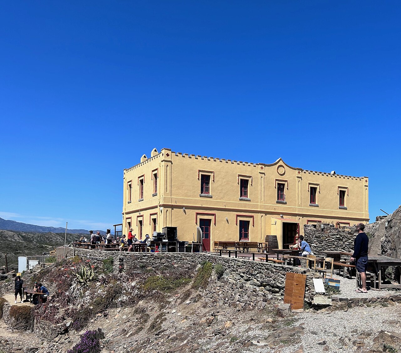
The tramuntana originates over the French Massif Central and accelerates through the Pyrenees, arriving on the northern Catalan coast as a cold, dry northerly that can gust close to 200 km/h and last for several days without a break.
It leaves an unmistakable signature. The sky turns an intense, scrubbed blue with no haze in it — tramuntana days produce the clearest light on this coast and the worst conditions to sit in it. Around Cap de Creus the sea is left very rough.
For our northern Costa Brava guides this is the governing wind. Platja Sa Conca near Cadaqués, Cala Joncols and Cala Montjoi all sit in tramuntana country, and a cove that is idyllic in still air becomes a wind tunnel with a chop running into it.
It is also worth remembering that Aiguablava faces north-east, a correction we made to our own guide after checking it. That orientation matters far more on a tramuntana or gregal day than any description of the sand.
Levante and Poniente in the Strait
Nowhere in Spain is the wind more decisive than around Tarifa, and the reason is topography. The mountains on both sides of the Strait of Gibraltar form what amounts to an east-west wind tunnel, so the two winds that run along its axis — levante and poniente — are both the strongest and the most frequent.
Levante blows from the Mediterranean through the Strait out into the Atlantic. It drops rain on the eastern flank of the Cádiz sierras and arrives on the coast dry, hot and turbulent, having lost its moisture on the way. It is the wind that built Tarifa’s reputation as a kitesurfing capital and the wind that makes an ordinary beach day there unbearable, because it drives sand horizontally across the shore. Local boat operators keep whale-watching vessels in port above around 21 knots of levante, which is a useful benchmark for what the sea is doing.
Poniente comes off the Atlantic in the opposite direction and is welcomed in summer for its coolness. It is generally the better wind for a beach day on this stretch.
A third name to know here is the vendaval, a south-westerly that leaves the sea particularly rough and can produce strong swell even in summer, most often in the mornings.
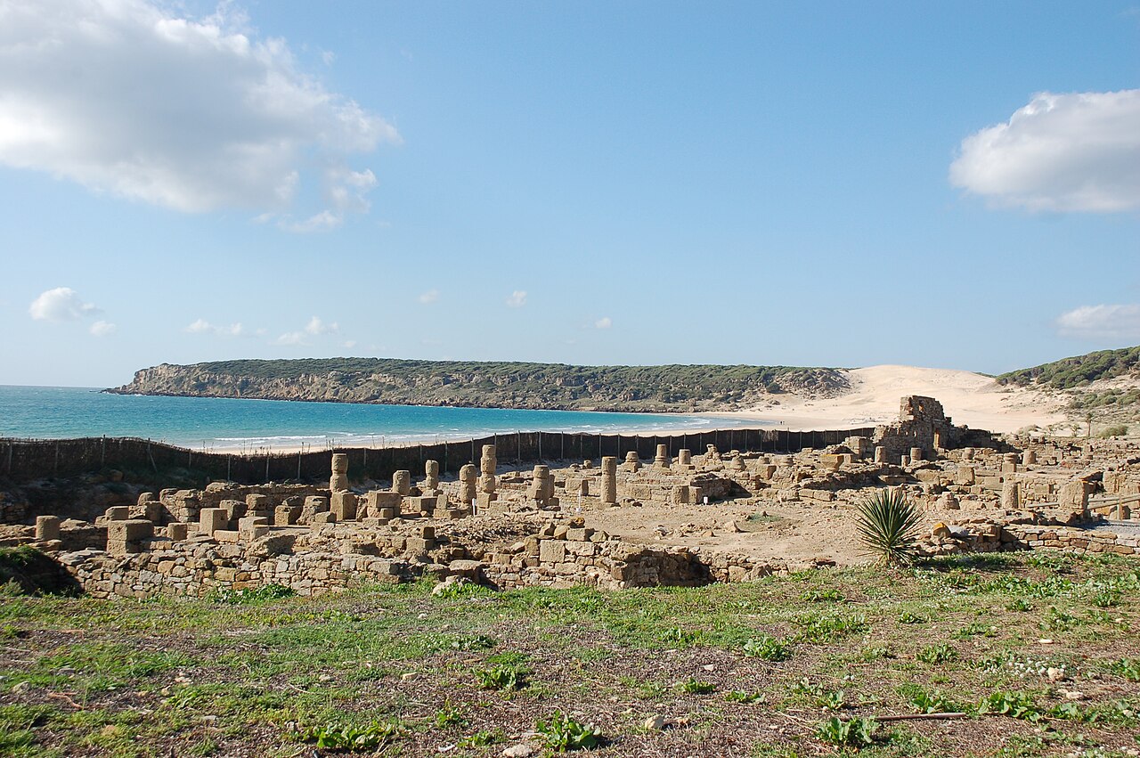
All four of our Costa de la Luz guides live under this system. The thirty-metre mobile dune at Playa de Bolonia is not a static feature; it is sand being moved by the wind, and it is still moving. El Palmar is a surf beach for the same reason it is an uncomfortable sunbathing beach on the wrong day. Los Alemanes and Cala de Roche both sit on this coast, and at Roche the tide decides which coves exist at all — a second variable stacked on top of the wind.
The Mediterranean Winds on the Eastern Coast
On the Alicante and Valencian coast the pattern is different, and gentler, but the same principle applies.
Poniente here arrives over land, warming and drying as it descends the Meseta through the foehn effect. In winter that produces the mild days the region is known for. In summer it is extraordinarily hot, dry and sustained — a poniente day in August is not a cooling breeze. It rarely produces serious storms on this coast, though when it blows hard it can raise substantial swell in the Balearics.
Levante on this coast arrives off the sea rather than through a mountain funnel, and it is the one that brings swell, chop and murky water to east-facing beaches. Long east-facing sands take it head-on. A cove tucked behind a headland with a northern or southern aspect may be entirely calm on the same afternoon.
Garbí deserves a mention for a reason that has nothing to do with the water. When it arrives from the south-west carrying Saharan dust, visibility drops, the light goes orange-brown, everything gets a fine coating, and the sea can look opaque without being rough at all.
Choosing a Beach by Orientation
The method, in three steps, takes about ninety seconds.
One: find the direction, not the speed. Any forecast will give you both. The direction is the one that changes your destination.
Two: pick a shore facing roughly the opposite way. With a tramuntana or gregal running, look for a cove that opens south or south-west and has a headland to the north of it. With a levante on the Mediterranean, look west-facing, or find a bay whose mouth points away from the east. In the Strait, a levante day sends you looking for shelter or, more honestly, somewhere else entirely.
Three: use the shape of the coast. Deep narrow coves between headlands are sheltered from far more directions than a long open beach, which is one of the underrated arguments for the small ones. A cove is protected from everything except the direction it opens towards.
Two secondary effects worth folding in. Wind moves the sand as well as the water, so on an exposed beach in a blow you will be sitting in it whether or not you go swimming. And an offshore wind that has flattened the surface has not made the sea safe — see the warning at the top of this article, and our guide to beach warning flags and lifeguard cover, because on most of the coves we write about there is nobody watching either way.
Checking Before You Go
AEMET, the Spanish state meteorological agency, publishes coastal and maritime forecasts as well as the general municipal ones, and the maritime forecast is the one that gives you wind direction, force and sea state together. Regional services publish their own — in Catalonia the Servei Meteorològic de Catalunya covers the tramuntana in far more detail than a national bulletin will.
One thing catches people out the first time they open it. The maritime bulletin is not written in kilometres per hour and metres of swell. Wind is given on the Beaufort scale and sea state on the Douglas scale, so a forecast reads as something like “NE 2 to 3, rising to 3 to 4 in the morning; marejadilla, locally increasing to marejada“. Those two words are Douglas scale steps, not adjectives: rizada is a ripple, marejadilla a slight sea, marejada a moderate one, and the scale climbs from there. It takes one afternoon to learn and it is the difference between reading the forecast the coastguard reads and reading a phone app’s summary of it.
The other number in the bulletin worth knowing is the direction convention: a wind is named for where it comes from, not where it is going. A north-easterly blows towards the south-west. Get that backwards and you will pick precisely the wrong cove.
One habit is worth more than any app. When you arrive at a viewpoint above the coast, look at the water before you commit to the descent. Wind chop is visible from a clifftop; you can see which end of a bay is sheltered and which is not, and you can see it before carrying everything down a path you will have to climb back up.
That is the entire argument of this article, and of most of what we write. The variable that decides a beach day is rarely the one in the brochure. It is the barrier, the ordinance, the lifeguard rota, the tide — and more often than any of them, the direction the air is moving.
Written as general information and not as a marine forecast or safety guidance. Wind names and their local usage vary along the coast, and the effects described here are broad patterns rather than predictions for a given day. Offshore winds flatten the surface while pushing floating objects and inflatables out to sea, and calm-looking water can be more dangerous than choppy water; do not judge conditions from appearance alone. Consult AEMET or the relevant regional meteorological service for current forecasts, follow the instructions of any lifeguard service on duty, and call 112 in an emergency.
Sources
Checked on 27 August 2026.
- The forecast to use. Agencia Estatal de Meteorología — predicción marítima, which publishes coastal and high-seas forecasts separately from the municipal ones, with warnings running 48 hours ahead, text forecasts 24 hours and map forecasts several days. This is the bulletin that gives wind direction, force and sea state together, which is the combination this article argues you need.
- How to read it. AEMET’s maritime meteorology page states the conventions: wind is expressed on the Beaufort anemometric scale and the state of the wind-driven sea on the Douglas scale. That is why the text bulletin reads in numbers and in words like rizada and marejada rather than in kilometres per hour and metres.
- What this article is not. It is a guide to reading conditions, not a forecast and not safety guidance. The wind names and their local usage vary along the coast; several have more than one form in Catalan and Spanish and are used inconsistently even by people who live with them. The effects described here are broad patterns, and a pattern is not a prediction for the afternoon you happen to be standing there.
- Figures we could not verify. Tramuntana gusts approaching 200 km/h; the benchmark of around 21 knots of levante above which Tarifa boat operators keep whale-watching vessels in port; and the attribution of the tramuntana’s origin to the Massif Central. All three are consistently repeated in regional sources and none has been matched to a published measurement or an operator’s stated policy. They are given as the figures commonly cited.
- The etymological point. The confusion between the levante wind and the Levante coast is one of the errors we contradict deliberately; it is listed on our corrections page along with the belief that tide tables govern the Spanish Mediterranean, which they effectively do not.
- The safety point, which is not decoration. An offshore wind flattens the surface and simultaneously pushes anything that floats away from the shore. Most of the coves described elsewhere on this site have no lifeguard and therefore no operating flag system at all — see what the colours mean, and who is watching. Where nobody is watching, the appearance of the water is the only signal on offer, and it is the one that misleads.
Image Credits
- Header and in-text image: Baelo Claudia at Playa de Bolonia, Tarifa, by Roland Geider (Ogre), released into the public domain, via Wikimedia Commons.
- In-article image: The Cap de Creus coastline, by Adrian Michael, licensed under CC BY-SA 4.0, via Wikimedia Commons.
Leave a Reply