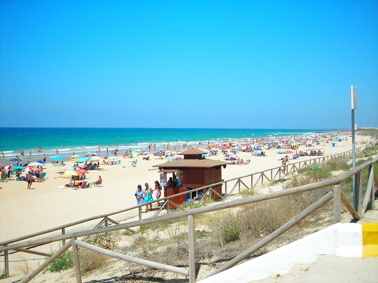
Until the A-2233 was built, getting to El Palmar meant crossing the Río Salado, a tidal inlet that flooded every time it rained properly and cut the place off from Conil for days at a time. That is the reason eight kilometres of Atlantic beach an hour from Cádiz stayed empty while the rest of the Spanish coast was being built on, and it is the reason it still looks the way it does: farmland, stone pine, grazing cattle, and low buildings that stop well short of the sand.
Surfers found it in the 1990s. Everyone else followed. The beach is now one of the best known on the Costa de la Luz, and — this catches people out — it is the only beach belonging to Vejer de la Frontera, a town eleven kilometres inland that most visitors never associate with the coast at all.
The River That Kept It Empty
El Palmar was never a fishing village. It was a rural settlement scattered around a dehesa — a wooded pasture, in this case of palms, which is where the name comes from — with wheat and sugar beet in the fields behind and cattle grazing among the trees. The sea was the edge of the farm, not the point of it.
What isolated it was water in the wrong place. The nearest town was Conil, and reaching it meant crossing the Río Salado, a saltwater inlet that regularly flooded and stopped carts, animals and eventually cars from getting through. A coast that is difficult to reach does not get developed, and by the time the road solved the problem, attitudes to building on dunes had changed. El Palmar came out the other side with its length intact and its skyline empty.
Standing above the sand at the northern end is the Torre de El Palmar, also called the Torre Nueva — one of the 16th-century watchtowers built along this coast against Barbary raiding. Its neighbour, the Torre de Castilnovo, marks the Conil boundary a little further north. Both are what passes for architecture here, and both are older than anything else in sight.
One Beach, Three Different Beaches
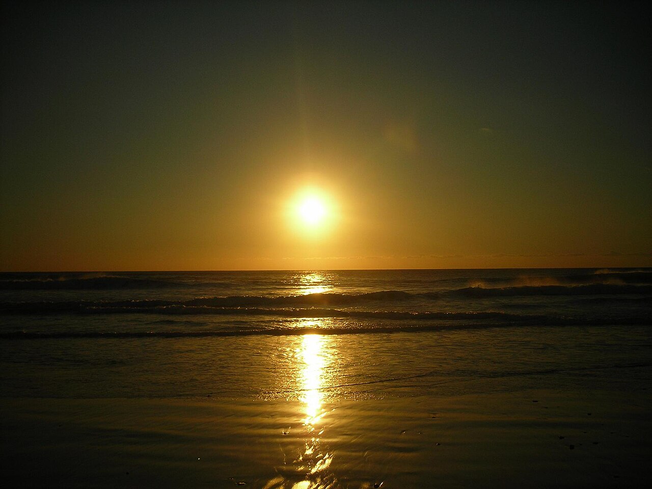
Measurements of El Palmar range from 4.2 to 8 kilometres depending on where they draw the boundaries, and 50 to 90 metres wide. Fine golden sand, low dunes, and greenish-blue Atlantic water that is several degrees colder than anything on the Mediterranean side of Tarifa. What matters more than the numbers is that it divides into three quite different beaches.
The northern end, running up towards Castilnovo, is the quiet one — families, walkers, and progressively fewer people the further you go. The middle is the busy part: surf schools, chiringuitos, the boardwalk, and everything anyone means when they talk about El Palmar’s atmosphere. South towards Zahora it thins out again and eventually runs on toward Los Caños de Meca and the Trafalgar lighthouse.
The dunes are crossed by boardwalks, which exist to keep several thousand pairs of feet off a fragile system rather than for convenience. About 1.5 kilometres of that boardwalk is flat and accessible, and the beach has an amphibious chair and adapted facilities — genuinely unusual on this coast, and the reason El Palmar holds the Blue Flag and the Q for tourist quality.
Why the Surf Works Here
El Palmar faces open Atlantic with nothing between it and the swell, and the sea bed is sand rather than reef — which makes it forgiving enough to learn on and consistent enough to be worth the trip for people who already know what they are doing. Several schools operate along the Paseo de la Playa all year, running lessons and summer camps.
The seasons work the opposite way round to the tourism. Autumn and winter bring the Atlantic storms and the best, most consistent swell, in cold water and empty line-ups. Summer is warm, gentle and crowded — fine for a first lesson, less interesting if you came for waves. Bodyboards, paddleboards and kayaks are rented locally; windsurfing and kitesurfing are not allowed at El Palmar itself, though beaches nearby take both.
Horse riding on the sand is the other thing people come for, with stables in the area running sunset routes along the neighbouring Playa Mangueta.
Getting There and Parking
From the A-48, take the A-2233 exit towards Vejer de la Frontera and follow the El Palmar signs from the roundabout marked Vejer Costa. Several unmarked lanes off that road drop onto different sections of the beach, which is worth knowing if the main approach is backed up.
There is free public parking for roughly 200 cars, plus paid lots near the busiest stretch in season. It is not enough in August, and the overflow ends up on the verges — which brings us to the part most guides leave out.
Transportes Comes runs buses connecting El Palmar with Vejer and other points in the province, with extra direct services in July and August. Out of season the frequency drops sharply, so check before relying on it.
Map
The Pressure It Is Under
Worth saying plainly, because the difference between June and August here is not subtle. In peak season the parking spills onto the dune edges, vehicles get much closer to the sand than they should, litter accumulates faster than it is cleared, and the combination of loose horses, quads and crowds has turned a beach people used to describe as wild into something noticeably more worn. Regular visitors have been complaining about exactly this for years.
None of which means don’t come. It means the version of El Palmar worth having is the one outside July and August, and that if you do come in summer, using the boardwalks, parking where you are supposed to and taking your rubbish home is the difference between being part of the problem and not.
What Happens Next Is Being Decided Now
The section above describes wear and tear. There is a larger question behind it, and it has been open for more than a decade.
Behind the beach lies an area known as Malcucaña, and what happens there is what will determine whether El Palmar in twenty years still looks like El Palmar. The original proposal, which surfaced publicly around 2013, was a resort: a hotel of some 1,300 beds plus more than 1,400 tourist apartments, on the scale that would have changed the character of the whole strip. Ecologistas en Acción and a local platform called Salvemos El Palmar campaigned against it, and proposed buying the land outright to stop it.
That version did not happen. What exists now is more modest and more complicated. The land is split between two owners — one plot held by Sareb, the state-linked company created to absorb property assets from the banking restructuring, the other by a private group — and by 2017 the proposal had been reframed as a single hotel rather than a resort, presented by Vejer’s council as sitting at the edge of the protected area and as an economic argument for a town that needs one.
Meanwhile the council has been moving in a different direction with the beach itself. In 2026 it put forward a project of around half a million euros, through European agricultural policy funding administered by the Andalusian government, aimed at protecting the dune frontage, improving accessibility and setting a sustainable management model — the explicit framing being that the landscape is the asset and the pressure is the threat.
Both of those things are true at once, which is the honest position. A beach that stayed empty because a river flooded a road is now being consciously managed for the first time, and the decisions being taken this decade are the ones that count.
Where this now stands. The rights are not extinguished, and the process is advancing rather than stalled. The land is classified as developable — suelo urbanizable, sector SUS-6 Malcucaña — and has a Junta de Compensación, the landowners’ body that carries out the urbanisation. Vejer’s council gave definitive approval to the reparcelación in 2022, describing a scheme with fewer rooms and less height and volume than the version the previous administration had entertained. Then, on 21 February 2024, the Junta de Andalucía’s territorial delegation in Cádiz granted the sector’s urbanisation project an autorización ambiental unificada, published in the Boletín Oficial de la Junta de Andalucía that May. What none of that tells you is when anything gets built, or whether it will. Planning consents in Spain can sit unused for years, and this one has been in progress for more than a decade already.
Eating, Staying, and When to Come
The seafront has a dense run of chiringuitos and restaurants, most of them seasonal — broadly April to November. Casa Francisco has been in the Michelin Guide since 2008 and is known for rice with lobster and almadraba tuna; Casa Reyes is the reliable choice for fresh fish, urta and sea bream included. El Cartero and El Dorado are where the beach turns into an evening. Book ahead in season.
There are no conventional hotels in El Palmar itself: rural houses, apartments and a large campsite beside the sand. Conil, Vejer and Barbate all have hotels within a short drive, and Vejer in particular is worth a night for the hilltop old town alone.
On timing: May, June and September are the sweet spot — water around 21–23 °C at the top end, space on the sand, and everything open. July and August are the busiest and the most degraded. October through March is cold water, near-empty beach and the best surf of the year. Further along this coast, Playa de Bolonia makes an easy comparison, and our ranking of the best beaches in Andalucía covers the wider region.
Practical Tips
- Walk north or south from the chiringuitos. Ten minutes buys you a different beach.
- Use the boardwalks. The dunes are what the beach is built on.
- Come in autumn or winter for the surf, not in August.
- Dogs are allowed October to May only, outside the official bathing season.
- Book Casa Francisco ahead. It fills, and it has for years.
- Check restaurant opening months in winter — most of the seafront closes.
General travel information, not professional or safety advice. Bus timetables, parking arrangements and seasonal restaurant hours change without notice — check with the Ayuntamiento de Vejer de la Frontera before planning around them. This is open Atlantic with currents to match: follow lifeguard instructions where the service is operating, and be aware it is seasonal. Keep to the boardwalks; the dunes are protected.
Sources
- The Malcucaña proposals. The scale of the original resort — around 1,300 hotel beds and more than 1,400 tourist apartments — was given by the Andalusian spokesperson for Ecologistas en Acción in statements to Europa Press, alongside the proposal by that organisation and the Salvemos El Palmar platform to buy the Sareb-held land in order to stop it. The later reframing as a single hotel, and the division of the site between Sareb and a private owner, were reported in the Cádiz press.
- The 2026 municipal project — approximately half a million euros for dune protection, accessibility and a sustainable management model for El Palmar, put forward by Vejer’s beaches department under the Andalusian government’s tourism funding within the 2023–2027 Common Agricultural Policy strategic plan — was reported in the regional press in March 2026. It was at that point pending funding.
- Where the Malcucaña rights stand. Until August 2026 this guide said it could not establish the legal position, and declined to fill the gap with press coverage. The position is documented in the Boletín Oficial de la Junta de Andalucía. A resolution of the Delegación Territorial de Sostenibilidad, Medio Ambiente y Economía Azul in Cádiz, dated 21 February 2024 and published in the bulletin that May, grants an autorización ambiental unificada to the Junta de Compensación of the SUS-6 Malcucaña sector for its urbanisation project, file AAU/CA/044/19. We cite it in text rather than by link because we have not verified the bulletin’s permanent address for that issue. The 2022 approval of the reparcelación, and the reduced scale of the current scheme, come from statements by Vejer’s urbanism delegate to the Cádiz press rather than from the council’s own publication. One thing we deliberately do not connect: a separate notice in the same bulletin in May 2026 concerns urban-discipline proceedings over a plot in the El Palmar area. It is a different file, and we have no basis for tying it to this sector.
- The watchtowers. The Torre de El Palmar, or Torre Nueva, and the Torre de Castilnovo to the north belong to the 16th-century chain of coastal towers built against Barbary raiding. Spanish castles and fortifications hold blanket protection as Bienes de Interés Cultural under the decree of 1949 and Ley 16/1985 del Patrimonio Histórico Español.
- Beach services and restrictions. Lifeguard season, dog access dates, the ban on windsurfing and kitesurfing at El Palmar itself, parking arrangements and bus timetables are set by the Ayuntamiento de Vejer de la Frontera and by Transportes Comes, and are revised annually. The published length of the beach varies between 4.2 and 8 kilometres depending on where the boundaries are drawn, which is why this guide gives a range.
- The Blue Flag. Where this guide refers to Blue Flag status, the award is administered in Spain by ADEAC, which publishes the list of awarded beaches (PDF). It is a voluntary certification a town hall applies for rather than a public designation, it measures municipal management rather than natural water quality, and the 2026 round runs for two years rather than one. Our guide to what the award measures sets out why several of the best coves in these guides do not have one.
Image Credits
- Header image: DSCN1344r by Gadeir, licensed under CC BY-SA 4.0, via Wikimedia Commons.
- In-article image: DSCN1669e by Gadeir, licensed under CC BY-SA 4.0, via Wikimedia Commons.
Leave a Reply