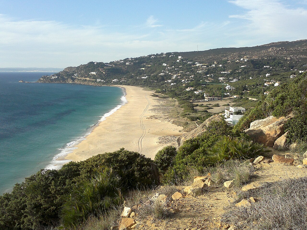
Nobody can tell you with any confidence why this beach is called Playa de los Alemanes. There are at least four versions in circulation locally, they overlap and compete, and only one of them comes with anything resembling a document attached. That is unusual — most Spanish beach names have a boring, well-attested origin — and it is the first thing worth knowing about a place that is otherwise 1,500 metres of empty Atlantic sand at the end of a staircase.
Officially it has two other names, Playa de Cabo de Plata and Playa de Aguaenmedio, and almost nobody uses either. It sits in Tarifa’s municipal territory, but you reach it through Zahara de los Atunes, which belongs to Barbate — one of those administrative absurdities that tells you the coast was divided up long before anyone came here to swim.
Four Stories About the Name
The first version is wartime: German crews putting in at the cove during the Second World War, with the Strait of Gibraltar a few kilometres away and heavily watched by both sides. It is the most repeated story, and the only testimony behind it we have been able to trace is one recollection: Margarita Neuer, daughter of the German consul and intelligence officer Gustav Draëger, told the journalist José María Irujo, in El País, that her father travelled regularly to this stretch of coast to take supplies out to German submarines. A memory published decades after the fact is not the same thing as a record, and we present it as what it is.
The second is earlier still: German families spending time on this coast before the war started, which is the strand the Spanish press tends to treat as best established, though not with a source we can follow to its origin. The third is postwar — Germans who ended up here afterwards and built huts on the slope above the sand at a time when nobody else wanted the land. That account is put forward by the local historian Javier Compás, who also wrote a novel around it; nothing of the huts survives. The fourth is simply the Atlanterra development itself, promoted from the 1960s onward and sold heavily to northern European buyers, with German names on a good number of the deeds.
These are not mutually exclusive, and that may be the whole answer: a name can settle by accumulation rather than from a single episode, and Germans turn up on this coast in every decade of the twentieth century. The honest position is that the last of the four is the only one anybody can actually show you evidence for. If you want the version that fits the landscape, though, stand on the sand and look east: the Strait, and Africa behind it, close enough that the whole coast has spent two thousand years watching who was coming across.
The Beach, and the Wind That Runs It
Roughly 1,500 metres long and 50 metres wide, fine golden sand, water somewhere between green and turquoise depending on the light. It runs between the headlands of Cabo de Plata and Cabo de Gracia, inside the Parque Natural del Estrecho, and it is effectively the continuation of Zahara’s own beach — though a hill sits between the two and there is no way along the sand from one to the other.
The Atlantic here is properly cold and often properly rough. Depending on who you are, that is the attraction or the problem. Windsurfers and kitesurfers come precisely for it, and the wind is as reliable here as anywhere near Tarifa. Anyone hoping to lie still on a towel should check the forecast the night before, because a strong Levante turns this beach into a sandblasting operation.
There are villas on the hillside above — Atlanterra — but nothing at sand level. No promenade, no chiringuito, no showers, no lifeguard. The houses look down on it and that is the extent of the development.
The Staircase
Access is the reason this beach stays empty while Zahara fills up. From Zahara de los Atunes you drive up through the Atlanterra urbanisation and keep following the signs for the Faro Camarinal along the CA-2216. Park near the lighthouse access, and from there a steep staircase drops to the sand — five to ten minutes down, rather more coming back.
It is not a difficult descent for anyone reasonably mobile, but it rules out pushchairs and wheelchairs entirely, and flip-flops are a bad idea in both directions. Parking is limited and informal; in August it is worth arriving early, and out of season it is a non-issue. The approach also runs past private property, which catches some visitors out — stay on the marked route.
Without a car it is awkward. COMES runs buses from Cádiz, Algeciras and Sevilla to Tarifa and Barbate, but the last stretch to Atlanterra needs a taxi.
Map
The Lighthouse on the Old Tower
The Faro de Camarinal, also called the Faro de Gracia, stands on the headland above the beach. What makes it worth the walk is what it is built on: a 16th-century almenara, a coastal watchtower known variously as the Torre Vieja, the Torre de Cabo de Gracia or the Torre del Cabo de Enmedio. The current light was put into service in 1989, sitting on top of four hundred years of earlier watching.
Those towers run all the way along this coast and were built against Barbary raiding — the same threat that emptied villages inland and produced the whole defensive architecture of southern Andalucía. From up here you get the Strait, the Moroccan coast on a clear day, and the beach laid out below.
About 500 metres beyond the lighthouse is Playa del Cañuelo, some 380 metres of sand with nothing at all on it — one of the last genuinely undeveloped beaches on this coast, and an easy addition to the same trip. The headland is also a good place to be in spring and autumn, when raptors funnel across the Strait on migration and peregrines and ospreys turn up regularly.
The Park Ends at This Headland
The guide above mentions that the beach sits inside the Parque Natural del Estrecho. That is worth a paragraph of its own, because the boundary runs right here: the park protects the coast from the ensenada de Getares at Algeciras all the way west to the Cabo de Gracia — which is the headland closing the far end of this beach. You are standing at the edge of it.
It was declared in 2003, covers roughly nineteen thousand hectares across the municipalities of Algeciras and Tarifa — the official figures differ, and the sources below give both, and is the southernmost protected space on the European continent. Before it got its present name it was known, less romantically, as the Frente Litoral Algeciras-Tarifa. The Duna de Bolonia, twenty minutes along the coast, was declared a natural monument inside its limits in 2001, and in the same year the park was declared it was also designated a Special Protection Area for Birds alongside the Playa de los Lances.
Then in 2006 UNESCO did something unusual with it. The Intercontinental Mediterranean Biosphere Reserve was proposed jointly by the Andalusian government and Morocco’s High Commission for Water and Forests, and declared as the first biosphere reserve to span two continents — and the first with a sea inside its boundaries. On the Spanish side it takes in Grazalema, Sierra de las Nieves, Los Alcornocales and this park; on the Moroccan side, the Talassemtane national park in the Rif.
Which is a formal way of saying what is obvious from the sand: the two coasts are one place, split by fourteen kilometres of water. The raptors crossing overhead in spring and autumn are working on that assumption, and so were the people who built the tower on the headland.
One geological detail for anyone walking out to the point: Punta Camarinal is known for its marmitas de gigante, the deep cylindrical potholes ground out of the rock by stones spun in the same spot by water over very long periods. They are listed among the notable features of the reserve, and they are underfoot rather than in a museum.
Zahara de los Atunes and the Almadraba
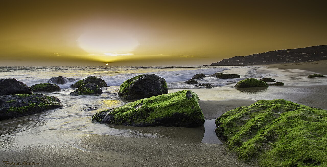
The village you drive through to get here is called Zahara of the Tunas for a reason. Bluefin tuna pass through the Strait every spring on their way into the Mediterranean to spawn, and come back out in summer, and the almadraba — a maze of nets anchored across their route — has been catching them here since Phoenician and Roman times. The Dukes of Medina Sidonia held the rights from the Middle Ages and built the walled compound in the village to process and guard the catch; Cervantes wrote about the place and the rough crowd the tuna season attracted.
The almadraba still runs, on a small quota, and the tuna is the reason to eat in Zahara rather than anywhere else nearby. There is no food at Los Alemanes at all, so the sensible plan is beach first, then lunch in the village. For staying, Atlanterra has villas and apartments with the view; Zahara has the range and the actual town.
When to Come
The sea peaks around 22–23 °C in August and sits near 16 °C through the winter, so this is not a coast for casual year-round swimming. June and September are the best compromise: warm enough water, fewer people on the staircase, and wind that is present without being relentless.
Spring and autumn are for something else — the lighthouse, the walk to Cañuelo, and the bird migration across the Strait. The beach is at its emptiest then, and the emptiness is most of the point. For alternatives further along this coast, Playa de Bolonia is twenty minutes away, and our ranking of the best beaches in Andalucía covers the wider region.
Practical Tips
- Closed shoes for the staircase. It is steeper than it looks from the top.
- Check the wind, not the temperature. A strong Levante decides the day.
- Eat in Zahara. There is nothing on the sand and nothing at the car park.
- Stay on the marked access route — the approach passes private land.
- Add the lighthouse and Cañuelo. They are the reason to make a morning of it.
- The Atlantic here is cold and often rough, and there is no lifeguard. Judge it yourself.
General travel information, not professional or safety advice. Parking arrangements at the Faro Camarinal access and bus services to Zahara and Atlanterra change from season to season — check with the Ayuntamiento de Tarifa before relying on them. There is no lifeguard at Los Alemanes and the Atlantic here can be genuinely rough: assess the sea yourself, and respect the private property along the access route.
Sources
- The park. Consejería de Sostenibilidad y Medio Ambiente, Junta de Andalucía — official record for the Parque Natural del Estrecho. Source for the 2003 declaration, the municipalities of Algeciras and Tarifa, the boundary running to the Cabo de Gracia, the 2001 declaration of the Duna de Bolonia as a natural monument within it, the 2003 ZEPA designation alongside the Playa de los Lances, the 2006 inclusion as a Site of Community Importance and the 2012 declaration as a Special Area of Conservation.
- The biosphere reserve. Ministerio para la Transición Ecológica y el Reto Demográfico — record for the Intercontinental Mediterranean Biosphere Reserve, declared by UNESCO in 2006 on a joint proposal from the Andalusian environment department and Morocco’s High Commission for Water and Forests, and the first intercontinental reserve of its kind.
- A note on the figures. The Junta gives the park’s protected surface as 19,177.29 hectares; other published accounts give 18,910. The biosphere reserve is variously given as 423,535 and 431,178.54 hectares. We describe both in round terms rather than choosing between the sources.
- The name of the beach. We looked again in August 2026 and found a fourth strand rather than an answer: alongside the wartime, postwar and Atlanterra explanations, the Spanish press describes German residents on this coast before the war began. None of the first three rests on documentation we can follow. The wartime version has one piece of testimony attached — Margarita Neuer’s account to José María Irujo in El País of her father, the consul and intelligence officer Gustav Draëger, taking supplies to submarines from this coast — and we cite it as a recollection given to a newspaper, not as an established fact about a named man. The postwar huts are the account of the local historian Javier Compás, who wrote a novel on the subject. Only the Atlanterra development, promoted from the 1960s and sold substantially to northern European buyers, is a matter of record. The guide presents all four because all four circulate, and says plainly which one is evidenced. If you have a source for either of the others, please tell us.
- Parking at the Faro Camarinal access, bus services and the almadraba season are set locally and by fishing quota respectively, and change year to year. Confirm with the Ayuntamiento de Tarifa before relying on any of it.
Image Credits
- Header image: Playa de los alemanes by Benjamincebrian, licensed under CC BY-SA 3.0, via Wikimedia Commons.
- In-article image: Atardecer en Zahara de los Atunes by Manuel Alejandro Montero Gil, licensed under CC BY 3.0, via Wikimedia Commons.
Leave a Reply