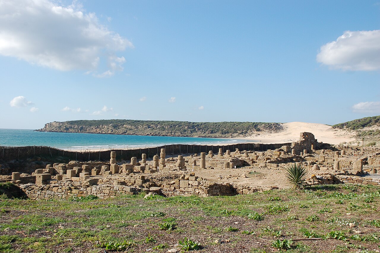
Most Spanish beaches are just beaches. Bolonia has a Roman city sitting on it — a real one, excavated and walkable, with its forum, its temples, and the stone vats where workers once packed fermented fish sauce for shipment across the empire. Behind the ruins, a sand dune thirty metres high is slowly swallowing a pine forest. Between the two runs almost four kilometres of pale Atlantic sand that has never been built on.
That combination is why Bolonia appears on every “most beautiful beach in Spain” list, and also why a day here works differently from a normal beach day. Two of the three reasons to come are not the water. So this guide starts with those.
The Roman City on the Sand: Baelo Claudia
Baelo Claudia was founded at the end of the 2nd century BC on the strength of two things: its position opposite Tangier, which made it a natural port for trade with North Africa, and the tuna that ran past its shore. The tuna mattered more. Salted fish and garum — a pungent fermented fish sauce that Roman cooking treated roughly the way modern kitchens treat soy sauce — were produced here in industrial quantities and shipped across the Mediterranean. The salting factory is one of the clearest parts of the site today: rows of sunken stone tanks, right at the back of the beach.
The town reached its height under Emperor Claudius, who granted it municipal status and the second half of its name. Then it stalled. A major earthquake in the 3rd century wrecked much of it, and although parts were reoccupied, the place was effectively finished by the 6th century and left to the sand. A French archaeologist, Pierre Paris, began excavating in 1917. Because nothing was ever built over the ruins, the street plan survived largely intact — which is why Baelo Claudia gives a far more legible picture of a small Roman town than sites buried under later cities do.
The site is run by the Junta de Andalucía and includes a visitor centre and museum with finds from the excavations. Entry is free for EU citizens, and it closes on Mondays. Allow an hour and a half if you want to read the panels rather than walk past them, and bring proper shoes — the ground is uneven stone and there is almost no shade over the forum.
The Dune That Is Burying a Forest
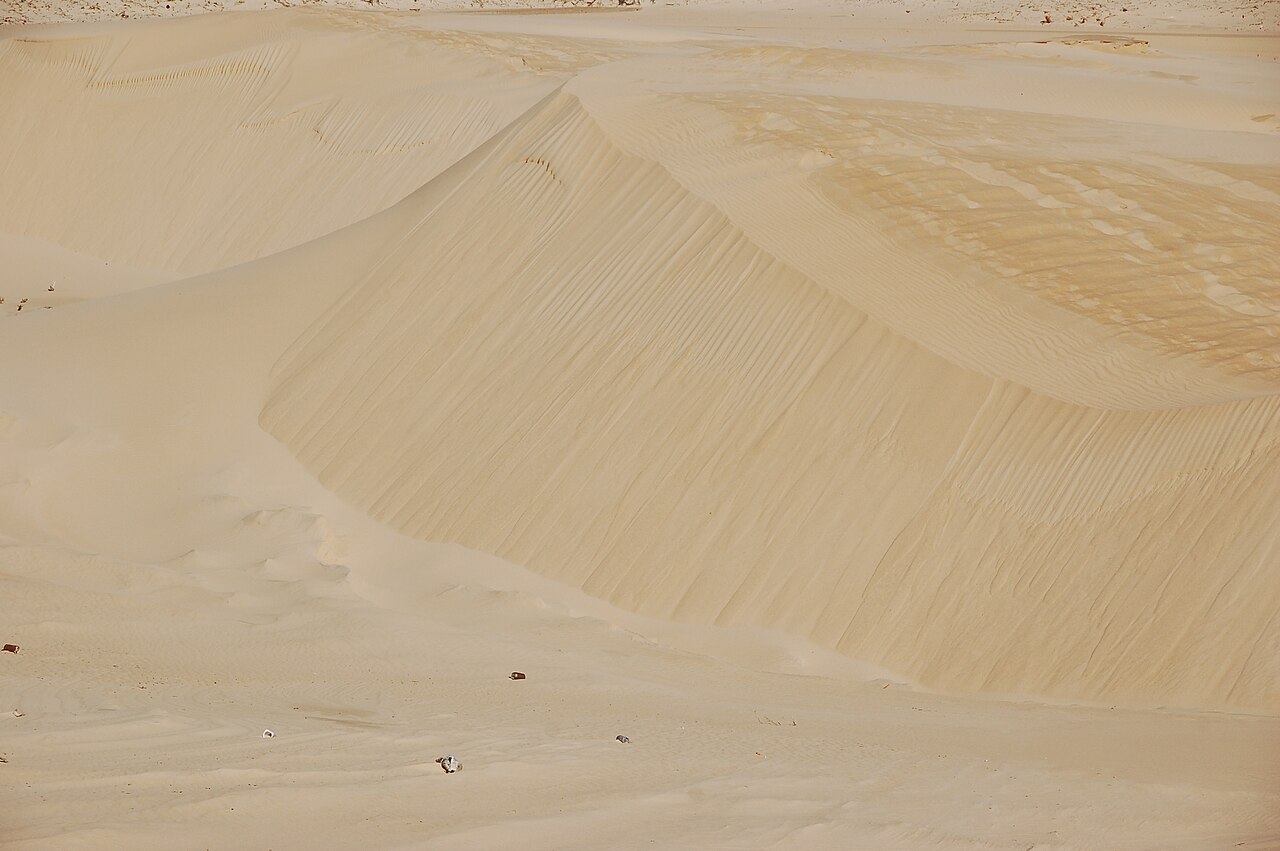
At the western end of the beach, on the isthmus of Punta Camarinal, sits an active dune more than 30 metres high and around 200 metres across. It was declared a Natural Monument by Decree 226/2001 of 2 October, in which the Junta de Andalucía designated a group of sites of geological value — the Trafalgar tombolo, the Nigüelas fault, the dinosaur tracks at Santisteban del Puerto and this among them. The protected area is 13.17 hectares.
It is a barján — a crescent-shaped dune lying across the wind, with unequal slopes — and one of the very few in Andalucía still genuinely transgressive, meaning still advancing inland. The easterly Levante pushes it a little further every year into a replanted stone pine wood, and the pines are dying by burial as it goes. The dune carries three layers of legal protection at once: the natural monument declaration, its position inside the Parque Natural del Estrecho, and its inclusion in the Natura 2000 network as a Special Area of Conservation within the Strait’s Special Protection Area for birds.
The obvious question is why nobody stops it. The answer is that the advance is a natural process, and current conservation policy is to let it happen rather than fix the dune in place. Almost nothing grows on the moving sand except marram grass, which survives being buried and helps hold the whole system together.
Climbing it is the standard thing to do here, and it is harder than it looks from the bottom: dry sand gives way underfoot, and the last stretch is steep. Go early or late unless you enjoy hot sand. Read the signs when you arrive, though, and do not assume this page settles the question: a monument with three overlapping conservation designations is a place where access conditions can be tightened, and they have been. The Consejería de Sostenibilidad, Medio Ambiente y Economía Azul announced a temporary closure of the monument’s waymarked path and viewpoint — an itinerary of 1,048 metres each way — with effect from 8 May 2026, for improvement works on the public-use facilities. We have that from regional press reporting the notice rather than from the notice itself, and we have found no reopening date, so read the signage when you arrive rather than planning the climb in advance. When it is open, from the crest you get the whole bay, the ruins below, and on a clear day the Moroccan coast across the Strait.
Where Bolonia Is, and What the Beach Is Like
Bolonia belongs to the municipality of Tarifa, in Cádiz province, and sits inside the Parque Natural del Estrecho, which is the reason this coast looks the way it does. Its extent is one of the figures the official sources do not agree on: 18,910 hectares in one, 19,177.29 in another. We give both rather than round it to a number that appears in neither, as this guide previously did. The bay runs between Punta Camarinal to the west and Punta Paloma to the east, facing Tangier across the water. The official figures are 3,800 metres of shoreline and an average width of 70 metres.
The sand is fine and very pale, and the water reads as turquoise in photographs in a way that sets up a certain amount of disappointment on arrival. This is the Atlantic at the mouth of the Strait: it peaks somewhere around 21–22 °C in late August and sits in the mid-teens through the winter, consistently colder than the Mediterranean beaches on the other side of Tarifa. The shelf also drops away fairly quickly near the shore in places, which is worth knowing if you are bringing small children.
Development amounts to El Lentiscal, a small settlement behind the dune with a handful of restaurants and houses. At the eastern end of the bay there are natural rock pools that can only be reached on foot along the sand — a long walk, and worth doing outside August. If you are working through this coastline, Playa de El Palmar further north offers a completely different version of the Costa de la Luz.
Getting There
By car
From Tarifa, take the N-340 north and watch for the Bolonia sign shortly after the Facinas junction, around kilometre 70. From there the CA-8202 runs about 8 kilometres down to the coast — narrow, winding, and slow if you meet a camper van coming the other way. Budget 20 to 25 minutes from Tarifa town.
There are several parking areas near the beach and by the archaeological site. In July and August they fill early and a fee is charged; the lots are informal and the surface is rough. Arriving before 11am makes a real difference, and so does being willing to walk five minutes from a further lot.
By bus
A seasonal bus connects Tarifa with Bolonia in July and August only. Outside those two months there is no public transport to the beach at all, and the practical options are a car or a taxi from Tarifa.
Map
The Wind Decides Your Day
More than season, more than water temperature, the variable that determines what Bolonia is like on any given day is which wind is blowing. This stretch of coast has two, and they produce completely different beaches.
The Levante comes from the east, off the Strait, and it can blow hard for days at a time. It is what built the dune and what keeps Tarifa’s kitesurfing industry in business. It is also what sends sand horizontally across the beach at ankle height and makes lying on a towel genuinely unpleasant. The Poniente comes from the west, off the Atlantic: gentler, cooler, better for swimming, and the condition most people picture when they imagine this beach.
The practical consequence is simple. Check the wind forecast the evening before rather than the weather forecast, because a sunny 30 °C day with a strong Levante is a bad beach day and an overcast one without it is not. June and September tend to give the best balance of warm water, manageable wind, and space on the sand. Winter is empty, frequently windy, and better suited to walking the bay and visiting the ruins than to swimming.
Eating and Staying in Bolonia
El Lentiscal has a cluster of beach bars and restaurants, several with terraces facing the sand, mostly built around Cádiz seafood — tuna in season, fried fish, and the local retinta beef for anyone who has had enough of the sea. There are not many of them relative to how busy the beach gets, so book for dinner in high season. Plenty of people also bring their own food and water, which is sensible given how little shade there is.
For accommodation, the village itself has guesthouses, small hotels and rural houses, which is the option if you want to be able to walk to the dune before breakfast. Tarifa, 20 minutes away, has far more range and puts you next to the ferry to Tangier and the whale and dolphin excursions that leave from the port. For alternatives elsewhere in the region, see our ranking of the best beaches in Andalucía.
Practical Tips
- Check the wind, not just the weather. A strong Levante changes the entire experience.
- Bring closed shoes for Baelo Claudia. The site is uneven stone and sandals are a bad idea.
- Bring water and shade. There is very little of either on the sand, and the beach bars are a walk away from most of it.
- Baelo Claudia closes on Mondays. Check current opening hours before building a day around it.
- Climb the dune early or late. Midday sand is punishing and the view is better with low light anyway.
- Carry cash for parking. The lots are informal and not always set up for cards.
Frequently Asked Questions
Is it suitable for young children?
Partly. The beach is huge and rarely feels crowded, but shade is scarce, facilities are thin, and the sea bed drops off quickly in places. Bring everything you need and pick a calm, Poniente day.
How long does the dune climb take?
Fifteen to twenty minutes of effort from the base, longer than the distance suggests because of the loose sand. There is no fixed path; people go straight up.
Written as general travel information, not as professional advice. Opening hours at Baelo Claudia, the summer bus service, and parking arrangements at Bolonia all change from one season to the next — check with the Conjunto Arqueológico de Baelo Claudia and the Ayuntamiento de Tarifa before you travel. The dune and the archaeological site are both protected areas: stay on marked routes, and keep off the ruins.
Sources
Checked on 27 August 2026.
- The dune’s protection. Decreto 226/2001, de 2 de octubre, por el que se declaran determinados Monumentos Naturales de Andalucía, published in the Boletín Oficial de la Junta de Andalucía, which lists the Duna de Bolonia among the sites declared for their geological value. The Junta’s environmental portal gives the protected area as 13.17 hectares, the height as over 30 metres, the location as the isthmus of Punta Camarinal, and the dune as open to the Levante.
- Why it keeps moving. The Junta’s own visitor material describes the formation as a barjanal — crescent dunes lying across the wind with unequal slopes — and as one of the few transgressive dune systems left in Andalucía, advancing into a replanted stone pine wood. It also records the triple designation: natural monument, Parque Natural del Estrecho, and Natura 2000 as a Special Area of Conservation inside the Strait’s bird protection area.
- Access to the dune. This guide previously said only that regional press had carried pieces about restrictions and that we could not establish what they were. We can now say more, though not everything. The Consejería de Sostenibilidad, Medio Ambiente y Economía Azul published a notice of temporary closure of the monument’s waymarked path and viewpoint, in force since 8 May 2026, for improvement works on public-use facilities; the same reporting gives the official itinerary as 1,048 metres one way. What we have read is the press account of that notice, not the notice on the Consejería’s own site, and we have not found a reopening date or a statement of whether the closure extends beyond the marked route to the dune face itself. The Junta’s own file on the monument does not carry it. Treat the signage on site as authoritative over this page.
- Baelo Claudia. The site is managed by the Junta de Andalucía, which publishes opening hours, closures and admission conditions. Those change; check them rather than relying on any guide, this one included.
- A figure we corrected. An earlier version of this guide gave the Parque Natural del Estrecho as “around 20,000 hectares”. Official sources give 18,910 and 19,177.29, and the rounding produced a number that appears in neither. Our guide to Playa Los Alemanes already declared that discrepancy; this page now matches it.
- What we could not verify. The foundation of Baelo Claudia at the end of the second century BC, the grant of municipal status by Claudius, the third-century earthquake and the abandonment by the sixth; the start of Pierre Paris’s excavations in 1917; the shoreline of 3,800 metres and average width of 70 metres; and the summer bus from Tarifa, which we describe as running in July and August only. These are consistently reported but we have not matched them to a published register or timetable, and the bus in particular should be confirmed with the Ayuntamiento de Tarifa before it is relied on.
- The wind. The contrast between Levante and Poniente here is geography rather than a citation, and it is the single most useful thing to check before setting out — see our guide to choosing a Spanish beach by the wind. Note that the wind called levante and the region called the Levante coast are different things, an error we deal with on our corrections page.
Image Credits
- Header image: Beach of Bolonia – 002 – Baelo Claudia by Roland Geider (Ogre), released into the public domain, via Wikimedia Commons.
- In-article image: Beach of Bolonia – 010 – dune by Roland Geider (Ogre), released into the public domain, via Wikimedia Commons.
Leave a Reply