The camins de ronda are usually introduced as scenic coastal footpaths, which is true and misses the point. They are the physical expression of a legal right, and on this coast they are the only reason a large number of coves can be reached at all. Take the path away and a long list of the coves on this coast could be reached only by boat.
They are also older, stranger and more fragile than the postcard suggests. Here is where they came from, what holds them open, which sections connect the coves we write about, and the things that close them — including one that has nothing to do with weather.
What This Guide Covers
- Where the camins de ronda came from
- The law that keeps them open
- How long they actually are
- The sections that reach our coves
- What closes them
- Walking them without regretting it
Where the Camins de Ronda Came From
The construction date is genuinely unknown, and the honest answer is that there isn’t one. These are accumulated paths rather than a built route: tracks between villages, beaches and coves that were probably in use for as long as anyone has lived on this shore.
What they were used for varied by century. Communication between coastal settlements. Fishing and cabotage trade. And a function that is easy to overlook: salvage. A path along the shoreline meant that fishermen and coastal sailors whose boat was wrecked on the rocks could walk back to their home port. Some of these routes have historically been called camins de salvament for exactly that reason.
The name that stuck came later. The Real Cuerpo de Carabineros de Costas y Fronteras was created in 1829 to watch the coastline, and the Guardia Civil absorbed its functions from 1940. Those forces walked la ronda — the patrol round — along these paths to intercept smuggling, and the name spread through the nineteenth and twentieth centuries. They have also been called caminos de cornisa, sendero de carabineros and paseo litoral, depending on who was writing.
The smuggling itself is worth a paragraph, because it explains the shape of the paths. Large ships on international routes would approach the coast at dusk or after dark and, without entering any port, slow down and transfer cargo to small fishing boats. The goods were hidden in the recesses of the coastline, and gangs of fifteen to twenty people then carried them from the hiding place to a lorry waiting inland. The cargo of the estraperlo years is a period portrait in itself: tobacco, alcohol, penicillin, pepper, sugar, chocolate, cosmetics and lingerie.
Some of the hiding places are still named on the map between Begur and Palamós — the cala del Port d’Esclanyà, the chalet of sa Perica at Tamariu, the Cova del Tabac, the cala del Cau, the cala dels Frares at the foot of the Cap de Sant Sebastià cliff, and the platja del Golfet. The Cova del Tabac did not get its name by accident.
The Law That Keeps Them Open
This is the part that almost never appears in English-language walking guides, and it changes how you read a locked gate.
The paths are not permissive routes granted by generous landowners. They run along a strip that Spanish coastal law imposes as a servitude on private property. Article 27 of the Ley 22/1988 de Costas establishes a transit servitude over a six-metre strip measured inland from the inner limit of the shore, which must be kept permanently available for public passage and for surveillance and rescue vehicles, and can be widened to as much as twenty metres where the terrain is difficult or dangerous. Earlier coastal legislation had used a wider salvage servitude, which is why some older sections sit further back than six metres would suggest.
Two practical consequences follow. The first is that where a camí de ronda squeezes between a villa’s garden wall and a cliff edge, that is not an oversight of planning — it is the servitude doing precisely what it was designed to do. The second is that the servitude runs along the shoreline and does not oblige anyone to build a path down to a cove from the road behind. We set out the whole architecture, including the access rule and its large exception, in our guide to the Ley de Costas.
How Long They Actually Are
You will see two figures quoted, and they are not reconcilable, so here they both are.
Tourism sources routinely give 200 kilometres between Blanes and Portbou. Reference sources give around 130 kilometres of actual path, running discontinuously between those same two points. The difference is almost certainly what each is counting: the length of coastline the network spans, against the length of walkable path that exists on the ground.
The word discontinuous is the one to hold on to. This is not a single continuous trail. It is a chain of surviving fragments, some of them centuries old, some rebuilt in the last thirty years, joined by road walking, town promenades and — in a few places — several kilometres of beach.
Much of the network coincides with the GR-92, the Sendero del Mediterráneo, rehabilitated in 1992 and marked with the standard red-and-white long-distance flashes, which in urban stretches sometimes appear on lampposts rather than rocks. At the northern end the route connects with the French sentier littoral, the chemin de ronde, across the border at Portbou.
The Sections That Reach Our Coves
Several of the beaches in our Costa Brava guides exist on a walker’s map and barely on a driver’s one.
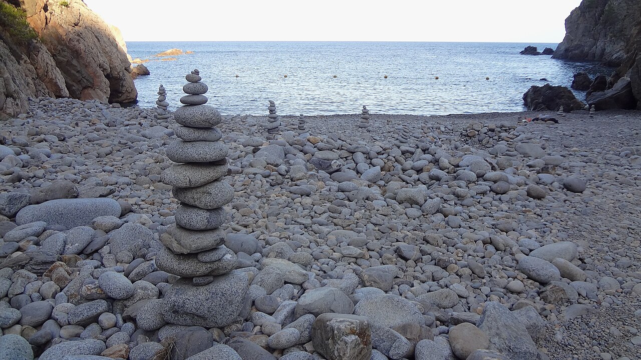
Palafrugell. The stretch from Llafranc through the calas of Calella de Palafrugell to the platja del Golfet is the section nearly every guide to this coast sends you to, and deservedly. It is also the way to Cala Pedrosa, where a restaurant operates with no road access whatsoever — every crate carried in on the path or brought by sea.
Palamós and Cap Roig. The coastal path links Platja de Castell with Cala Estreta and the smaller coves beyond it. Castell has a car park; Estreta effectively does not, and the walk is the access.
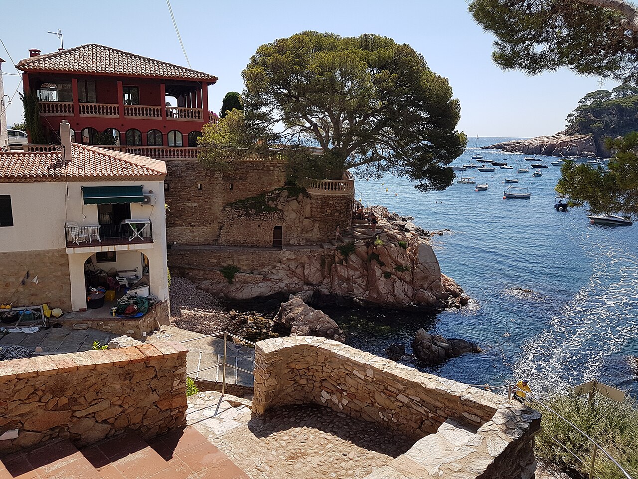
Begur. The headlands around Aiguablava and Sa Tuna are threaded by some of the most photographed sections of the network.
Blanes and Lloret. The path runs past Cala Sant Francesc and over the rocks to Cala Treumal and Santa Cristina. Signage on this stretch has been reported as confusing north of Cala Morisca, so a downloaded track is worth having.
Cadaqués. The route out to the Cala Nans lighthouse, roughly 2.8 kilometres each way, passes Platja Sa Conca and is the gateway to the Cap de Creus sections.
Tossa de Mar. The path above Cala Pola is the alternative to driving in through the campsite, and on a summer weekend it is the better option by some distance.
What Closes Them
Three things, and only one of them is obvious.
Storms. The reference case is Gloria, which struck the Mediterranean coast between 19 and 24 January 2020. The Spanish environment ministry declared the coastal repairs emergency works. Its own release valued them at 19.75 million euros, of which 5.75 million went to Catalonia; the note the Moncloa press office issued on the same resolution gives 19.5 million and a smaller Valencian share. Two central-government statements about one decision do not agree, and we would rather say so than average them. In Girona province alone, the consortium managing the greenway network estimated over 1,155,800 euros of damage to its own routes.
What deserves attention is what the ministry said alongside the money. Its own statement observed that increasingly frequent and destructive storms have produced ever larger emergency works, that this reactive approach does not achieve durable solutions, and that virtually all such reconstructions require another reconstruction almost immediately. That is an unusually candid thing for an administration to publish about its own programme, and it is the honest frame for any coastal path on this shore: it is being rebuilt roughly as fast as the sea takes it.
Maintenance. Sections close for safety and accessibility works, sometimes for months. At the end of 2025, parts of the GR-92 in the Begur area were reported as temporarily inaccessible for exactly that reason. Municipal websites are the place to check; the tourist office in the town you are starting from will know.
Wildfire risk. This is the one nobody warns visitors about. Catalonia’s Pla ALFA sets graded fire-risk levels, and at the highest level access to the Parc Natural de Cap de Creus can be restricted. A footpath that closes because of the fire index rather than the sea state is not intuitive to anyone arriving from northern Europe, and in a dry August it is a real possibility on the northern sections.
Walking Them Without Regretting It
A few things that are obvious after the first attempt and not before it.
These are not promenades. Sections are narrow, uneven, stepped and exposed, with drops to one side. Proper footwear is not a formality. Wet rock after rain is the single most common cause of trouble.
Plan the return before the outbound. Almost all the good sections are linear rather than circular. Getting to the far end is the easy half. Bus timetables on this coast thin out considerably outside July and August.
Watch the ravines. Where a stream reaches the sea, the crossing can be impassable after rain and the marked route may simply stop. This is a known feature of the network rather than a fault in your map.
Carry water, and expect none. Most of the coves along the way have no drinking water, no shade and no services, and the sections between towns have nothing at all.
Spring and autumn are better than summer. The paths face the sea and much of the exposure is unshaded. May, June, September and October give you the same coast at a temperature that lets you enjoy it, and the water in late September is warmer than in June.
Do not assume a lifeguard at the other end. Most of the coves these paths reach have no supervision at all, which is a separate calculation from the walk itself — we go through what that means in our guide to beach warning flags and lifeguard cover.
Written as general information and not as route guidance or safety instruction. The camins de ronda are unsurfaced coastal paths with exposed sections, steps, loose surfaces and unprotected drops; conditions vary with weather and season, and sections are closed for storm damage, maintenance and wildfire risk without much notice. Distances and difficulty grades published by different sources for the same stretch frequently disagree. Check the current status with the town hall or tourist office where you intend to start, carry a downloaded track and enough water, and turn back rather than improvise a route around a closure. In an emergency, call 112.
Sources
- Ley 22/1988, de 28 de julio, de Costas — official ELI permalink, Boletín Oficial del Estado no. 181, 29 July 1988; full text. The legal basis of the camins de ronda is article 27.1: a right-of-way easement over a six-metre strip measured inland from the inner limit of the shore, which must be kept permanently clear for public pedestrian passage and for surveillance and rescue vehicles. Article 27.2 allows that strip to be widened to a maximum of twenty metres where the passage is difficult or dangerous, which is what much of this coastline is. Article 28 sets out the separate easement of free public access to the sea.
- The easement is imprescriptible under article 21.1 of the same law: it cannot be lost through the passage of time, however long a stretch of path has been obstructed, and it prevails over any action brought against it.
- Signposting, waymarking, seasonal closures and the maintenance of individual sections are the responsibility of the relevant town halls and of the Generalitat de Catalunya, not of the coastal legislation. Confirm the state of a route with the local town hall before walking it: sections do close after storms and landslips.
- The two lengths. The 200-kilometre figure between Blanes and Portbou comes from tourism promotion material; the figure of around 130 kilometres of walkable path comes from reference sources. We have found no survey that reconciles them, and we doubt one exists, because the two are almost certainly measuring different things — coastline spanned against path on the ground. Both are given above rather than averaged into a number that would be nobody’s.
- Storm Gloria and the emergency works. The resolution announced by the Ministerio para la Transición Ecológica y el Reto Demográfico on 17 February 2020 declares the coastal repairs emergency works, dates the storm to 19–24 January 2020 and values the repairs at 19.75 million euros, of which 5.75 million for Catalonia. The note the Moncloa press office published on the same resolution gives 19.5 million and a smaller Valencian share. Two central-government releases about one decision disagree, so both are published here. The ministry’s own remark — that reactive rebuilding does not produce durable solutions, and that almost every such reconstruction needs reconstructing again almost at once — is taken from those releases.
- Wildfire closures. The graded fire-risk levels are the Pla Alfa of the Generalitat de Catalunya, published daily by the Cos d’Agents Rurals. At level 4 the restriction in the Parc Natural de Cap de Creus extends to people on foot and on bicycles, not only to vehicles, and the camí de ronda itself closes on part of the Roses coast — set out in our guide to Cala Montjoi.
- The name and the patrols. That the Real Cuerpo de Carabineros de Costas y Fronteras was created in 1829 and that its functions passed to the Guardia Civil in 1940 are the dates given in the standard accounts. The association of the patrol round with these particular paths, the alternative names, and the smuggling detail down to the cargo lists and the named hiding places follow local Costa Brava histories rather than an archival source we have read ourselves.
- What we have not verified. The figure of more than 1,155,800 euros of damage to the Girona greenway network, and the reports that GR-92 sections around Begur were inaccessible for works at the end of 2025, are given as reported and not checked against a primary document. This guide also carried gusts of 130 km/h and seven-metre waves for Gloria; published wind and wave figures for that storm vary widely and we have removed ours rather than pick one.
Image Credits
- Header and in-text image: Cala d’Aiguablava, Begur, by Myriam Thyes, licensed under CC BY-SA 4.0, via Wikimedia Commons.
- In-article image: Cala Pedrosa, Tamariu, by Isidro Jabato, licensed under CC BY-SA 4.0, via Wikimedia Commons.
Leave a Reply