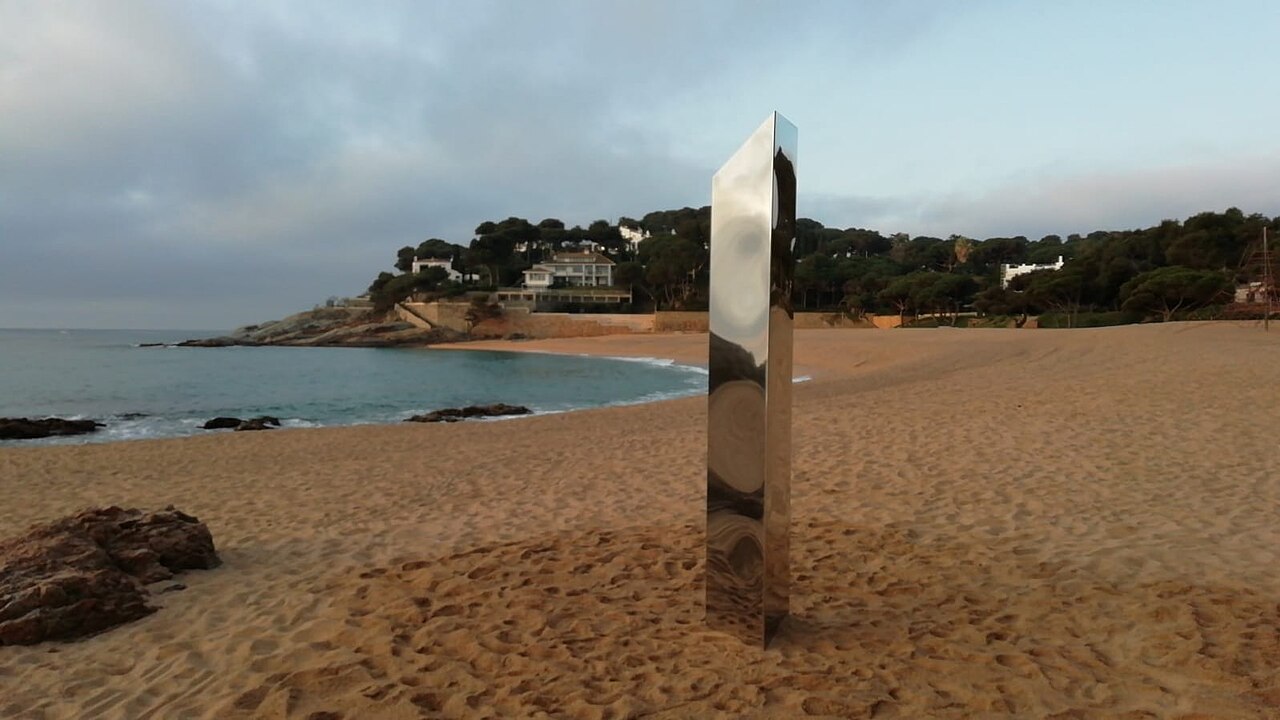
On the morning of 30 March 2021, the people of S’Agaró woke up to find a three-metre stainless steel prism standing in the middle of Sa Conca. It had been fixed into the sand overnight, next to the rock island that divides the beach in two, and its mirrored faces reflected the water, the sand and the pines. Nobody had asked for it. Nobody claimed it. For two days it was the most photographed object on the Costa Brava.
The Morning the Monolith Appeared
Sa Conca’s monolith was part of a genuinely strange global episode. The first of them turned up in the Utah desert in November 2020, and over the following months near-identical steel prisms appeared and vanished in the United Kingdom, Romania, the Netherlands and Poland. Nobody has ever satisfactorily explained the sequence. The comparison everyone reached for was the slab in Kubrick’s 2001: A Space Odyssey, and it was a fair one.
The Catalan one was a hollow triangular prism, its tallest face about three metres, bolted to a base sunk in the sand. The local cinema association Arocinema posted the find at first light and had to spend the rest of the day insisting it was not their doing. Within hours the town council had roped it off — a Covid-era precaution, because too many people were arriving to touch it.
Elsewhere in the world the monoliths tended to disappear as mysteriously as they arrived. This one did not get the chance. Two days later, at around seven in the morning, a group of young men levered it off its base and dropped it flat on the sand. Neighbours called the Local Police, a fisherman pointed the officers in the right direction, and they were all identified within the hour. Whether anything came of it legally was never clear, for a very Catalan reason: the sculpture had no owner to press a complaint.
The council kept it. It was moved to the Parc dels Estanys in Platja d’Aro, where the municipal art collection is displayed, and it is still there. So the monolith is no longer on the beach — but Sa Conca is the beach it chose, and the Parc dels Estanys is a fifteen-minute walk inland if you want to see how the story ended.
What the Beach Is Like
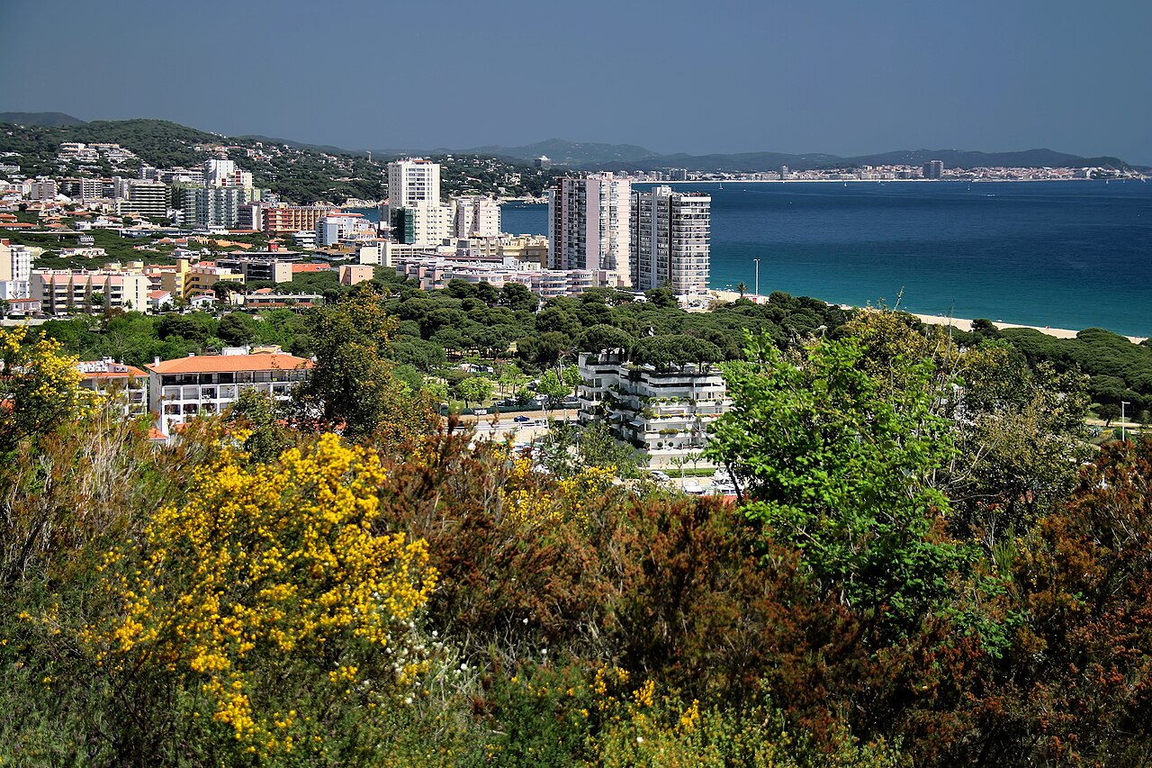
Around 385 to 400 metres of shoreline, with a rock island partway along — the Illot de sa Conca — that does something useful: it splits the bay into two beaches with two different jobs. The far half has a name of its own, Platja dels Oriços, the sea urchins’ beach, which tells you plainly enough what is on the bottom over there. The seabed on one side is sand — the swimming side, the family side, the one with the children’s water platform. The other side is rock, and it is where the snorkellers go, because the pools and pockets around the island hold urchins and small fish in water shallow enough for a child with a mask.
The sand is coarse and golden and does not cling to skin the way fine sand does, which is a small pleasure but a real one. The slope into the water is fairly steep, as it is almost everywhere around Platja d’Aro, so the family reputation comes with the usual caveat about watching children at the edge.
Everything else is here: Blue Flag, lifeguards in season, showers, toilets, two chiringuitos, sunbeds, wheelchair-accessible walkways, adapted toilets and a bathing assistance service. Nudism is not permitted and camping is prohibited.
Why the Beach Changes Size (and Why It Isn’t the Tide)
You will read almost everywhere that Sa Conca is five metres wide at high tide and seventy at low tide. The figures are roughly right. The explanation is wrong, and it is worth correcting because it sends people to the beach with a tide table for no reason.
The Mediterranean on this coast has a tidal range of around twenty centimetres. On a beach with this gradient, twenty centimetres of water level moves the shoreline by a stride or two — not by sixty-five metres. What actually changes the width of Sa Conca is the sand itself: winter easterlies drag it offshore and pile it into bars, spring and summer bring some of it back, and the difference between a beach after a hard winter and the same beach in August is enormous.
The practical version: check the season and recent storms, not the tide table. A visit in April after a rough winter can find a strip of sand you would not recognise from the summer photographs.
The Camí de Ronda from Sant Pol
The 2.5-kilometre coastal path between Platja de Sant Pol and Sa Conca is, by fairly broad agreement, the finest short walk on the Costa Brava, and an estimated million people a year do it. It takes about twenty-five minutes.
What makes it different from every other camí de ronda is that this one was designed. It is the only architecturally conceived coastal path on the Costa Brava, and it is protected as a cultural asset of national interest. It belongs to S’Agaró, the garden-city development promoted by the Ensesa family and laid out from the 1920s by the Girona architect Rafael Masó i Valentí, a pupil of Gaudí. The first villa, Senya Blanca, was built for Josep Ensesa i Gubert — accounts date it to 1924 or 1925 — and the path itself carries his name. The balustrades, the steps cut into the rock, the pergolas and the eight-columned mirador standing over the Esculls de la Font are all deliberate architecture, not a fishermen’s track that happened to survive. Interpretation panels along the route explain the geology of the rock underfoot.
Walk it in one direction at least. If you only do it once, go from Sant Pol towards Sa Conca in the late afternoon.
How to Get to Sa Conca
By Car
Reached from the C-253 from either Platja d’Aro or S’Agaró. Parking near the beach is limited and its capacity and charges change from season to season; the Port d’Aro marina area a short walk away is the usual overflow. In July and August, early or not at all.
On Foot
Twenty-five minutes on the camí de ronda from Sant Pol, or a flat walk south along the seafront from the centre of Platja d’Aro. Both are better than driving, and the first is a reason to come in itself.
Map
Eating and Sleeping Nearby
Two chiringuitos on the sand, one at each end, and the rest is a question of which town you walk into. Platja d’Aro gives you a full resort’s worth of restaurants at every price point, a long shopping street and a nightlife scene. S’Agaró gives you the other thing entirely: a hundred metres from the beach stands the Hostal de la Gavina, opened in 1932, five stars, and for decades the address on this coast.
The same split runs through the accommodation. La Gavina is the prestige option and prices accordingly; Platja d’Aro has the hotels and apartments in volume, all within a walk of the beach along the seafront.
When to Go
Sa Conca is busy all summer and there is no clever trick that makes it otherwise: it serves a resort town on one side and a residential estate on the other, and both turn up. The question worth planning is not when but where — which half of the beach you want. The sandy side if you are swimming or have small children, the rocky side by the island if you have a mask and any interest in what is under the surface. They are twenty metres apart and they are not the same day out.
June and September give warm water with the crowd thinned out. April, May and October are for the camí de ronda rather than for swimming, and that is a perfectly good reason to come — the walk is better in mild weather than in August heat, and the beach at the end of it is quiet. For how Sa Conca compares with the rest of the region, see our Costa Brava beach rankings. For the opposite kind of day entirely, Cala del Senyor Ramon is half an hour south and has nothing on it at all.
Practical Tips
- Pick your side before you put the towel down. Sand for swimming, rock and island for snorkelling.
- Ignore the tide table. The width varies with the season and recent storms, not with the tide.
- Arrive on foot from Sant Pol. Twenty-five minutes, spectacular, and it removes the parking problem.
- Watch small children at the water’s edge. The entry is steeper than the beach’s family reputation suggests.
- Walk to the Parc dels Estanys if the monolith story appeals. That is where the council put it after it was pulled down.
Frequently Asked Questions
Is this the same Sa Conca people mean when they talk about Cadaqués?
No, and the two get confused constantly. Sa conca is Catalan for “the basin”, a shape common enough that the name occurs twice on this coast. This one is at Castell-Platja d’Aro, between a resort town and the S’Agaró estate, with a Blue Flag and two chiringuitos on it. The other Sa Conca is at the southern edge of Cadaqués, an hour and a half up the coast: 125 metres of rock and gravel with no services at all, and the trailhead for the walk to the Cala Nans lighthouse. If a review mentions a lighthouse, or a monolith, you can tell immediately which one is being described.
Written for general information, not as travel, legal or safety advice. The entry into the water at Sa Conca shelves steeply and lifeguard cover is seasonal. The usable width of the beach varies substantially through the year, and the camí de ronda includes steps and unfenced rock sections that are slippery when wet. Parking capacity and charges around the beach and Port d’Aro change from season to season. Confirm current details with the Ajuntament de Castell-Platja d’Aro before travelling.
Sources
Checked on 27 August 2026.
- The camí de ronda. The Sant Pol to Sa Conca stretch is described consistently across Catalan walking and tourism sources as the only camí de ronda on the Costa Brava of architectural rather than merely practical origin, and as declared a cultural asset of national interest. Source also for its promotion by the Ensesa family, the design by Rafael Masó i Valentí, the garden-city concept, the naming of the path after Josep Ensesa i Gubert, and the eight-columned mirador at the Esculls de la Font.
- What we corrected. An earlier version dated the path’s reconditioning to 1916. That does not fit: S’Agaró was laid out in the 1920s, and the first villa, Senya Blanca, is dated by different accounts to 1924 or 1925. We could not source the 1916 figure at all and have removed it rather than adjust it. We have also dropped the count of fourteen interpretation panels, which we could not verify.
- The two beaches. The rock island is the Illot de sa Conca and the beach on the far side of it is the Platja dels Oriços — literally the sea urchins’ beach, which is a better explanation of the snorkelling than anything we could write.
- The tide point. The figures of five metres wide and seventy metres wide circulate widely with a tidal explanation attached. The tidal range on the Spanish Mediterranean coast is of the order of twenty centimetres, which cannot move a shoreline sixty-five metres on any gradient. Seasonal sand transport and winter storms can and do. This is one of the errors we contradict deliberately, and it is listed on our corrections page.
- The monolith. The episode is documented, and a photograph of the object at Sa Conca credited to the Arocinema association is published under a free licence on Wikimedia Commons — see the image credits below. The wider sequence of steel prisms beginning in Utah in November 2020 is a matter of public record. What we have not been able to source to a document is the detail: the exact date of 30 March 2021, the two-day duration, the hour it was pulled down, the identification of those responsible, and the absence of any owner able to bring a complaint. Those come from press accounts of the time. The council’s relocation of the piece to the Parc dels Estanys is worth confirming before making a trip of it.
- What we could not verify. The estimate of a million walkers a year on this path; the stated length, given variously as 2 and 2.5 kilometres; the beach measurements, for which the national register is the Guía de Playas of the Ministerio para la Transición Ecológica y el Reto Demográfico (Fuente: © Ministerio para la Transición Ecológica y el Reto Demográfico); and the opening date of 1932 for the Hostal de la Gavina, which the hotel and local sources give consistently but which we have not seen in a public register.
- Beach rules and services. The Blue Flag, lifeguard season, accessibility provision, the prohibition on nudism and camping, and the parking arrangements are all set by the Ajuntament de Castell-Platja d’Aro, exercising the municipal competences given by article 115 of the Ley 22/1988 de Costas, and they are reviewed every season.
- The Blue Flag. Where this guide refers to Blue Flag status, the award is administered in Spain by ADEAC, which publishes the list of awarded beaches (PDF). It is a voluntary certification a town hall applies for rather than a public designation, it measures municipal management rather than natural water quality, and the 2026 round runs for two years rather than one. Our guide to what the award measures sets out why several of the best coves in these guides do not have one.
- The accessibility provision. The wheelchair walkways, adapted toilets and assisted bathing service listed here are provided by the Ajuntament de Castell-Platja d’Aro, run seasonally and depend on staffing. We have not confirmed the 2026 dates, hours or booking arrangements with the town hall. If you are making the journey on the strength of the assisted bathing service in particular, telephone ahead: it is the kind of provision that is fully staffed in August and absent in October, and the cost of assuming otherwise falls on the visitor least able to absorb it.
Image Credits
- Header image: Monòlit sa Conca by Arocinema, licensed under CC BY-SA 4.0, via Wikimedia Commons.
- In-article image: Platja d’Aro by Jorge Franganillo, licensed under CC BY 2.0, via Wikimedia Commons.
Leave a Reply