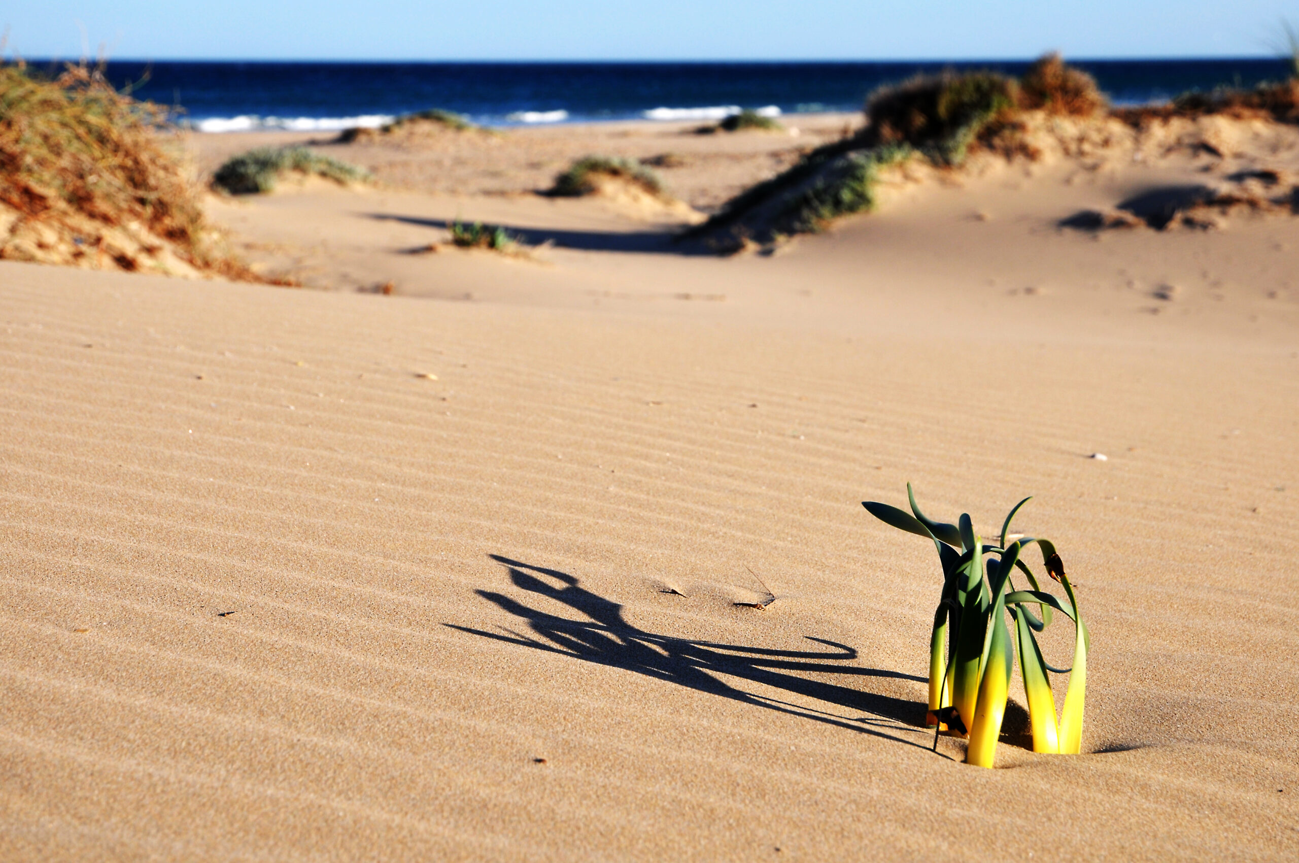
The dune system behind this beach is among the best preserved in the province of Alicante — mobile dunes, semi-fixed dunes, fossil dunes, and pine woods holding the whole thing together. That is the reason to come, and it is also the reason you are asked to stay on the boardwalks. It is also why this is not a beach to arrive at with a dog in high season: protected dune systems are one of the standard grounds on which Alicante municipalities keep animals off the sand, as we set out in our guide to dog beaches in Alicante. Playa del Carabassí sits twenty minutes from Alicante airport and still manages not to feel like it.
For the urban version of the same coastline, Playa de San Juan north of the city has the same golden sand and every service you could want.
Where Is Playa del Carabassí?
Within the municipality of Elche, province of Alicante, at the boundary with Santa Pola and just south of the Arenales del Sol urban beach. It lies at the foot of the Sierra del Carabassí, with the Clot de Galvany wetland immediately inland — which is the key to understanding the place.
Roughly 20 kilometres from the city of Alicante and a short drive from the airport, which makes the semi-wild character of the beach genuinely surprising the first time you see it.
The Development That Never Happened
A wild dune system twenty minutes from an international airport is not an accident of geography. It is the result of an argument that was very nearly lost.
In the late 1970s a developer moved on the Clot de Galvany with drainage works and earth-moving that changed the shape of the ground. The plan was a large urban development, and the detail that tells you everything about the period is what was to happen to the wetland itself: the natural pool the place is named after would be drained, and an artificial lake built in its place. A real marsh, replaced by an ornamental one, as an amenity for the housing that would surround it.
Public opposition stopped it. Not a court ruling and not a conservation designation — neither existed here at the time — but sustained local pressure, at a moment when the entire Alicante coastline was being built on and almost nothing else survived the decade intact. Gran Alacant went up to the south. Arenales del Sol went up to the north-east. The Clot did not.
The Ayuntamiento de Elche subsequently bought the land and began the long work of putting the wetland back together. Protection came much later and in layers: inclusion in the Valencian Catalogue of Wetlands, designation as a Site of Community Importance and a Special Protection Area for Birds under Natura 2000, and finally, by agreement of the Consell de la Generalitat on 21 January 2005, declaration as a Paraje Natural Municipal. It is also registered as a Biological Station. Today the site is managed by Aigües d’Elx in collaboration with the town hall.
Which is worth holding in mind on the boardwalk. The reason there is a pine wood and a dune belt here rather than a housing estate is that a group of people in Elche spent the late 1970s refusing to let it go.
The Dunes Are the Point
Most beaches in these guides are a shoreline with something behind it. Here the thing behind the shoreline is the attraction. The Clot de Galvany protected area covers around 360 hectares of wetland, salt flats, pools, hills, and the dune belt that connects them to the sea, and the dune formation it holds is among the most complete in the province: high mobile dunes at the front, semi-fixed and fixed dunes behind, fossil dunes older still, and a dense cover of Aleppo and stone pine over the top.
Between the sand and the pines grow sea daffodils (Pancratium maritimum), sea fennel on the rockier ground, and tamarisk on the dunes closest to the wetland. The birdlife is the other half of it: the wetland behind supports marbled teal, squacco heron, white-headed duck and ferruginous duck, and the shoreline itself draws plovers and sandpipers. There are hides in the protected area for anyone who wants to take that seriously.
A network of numbered wooden boardwalks — roughly 1 through 6 — crosses the dunes from the car parks to the water. They exist to keep feet off the vegetation that physically holds the dunes in place. Walking around them is not a minor infraction against a sign; it is the mechanism by which dune systems collapse.
It is also not advisory in the legal sense. The 2005 declaration carries its own set of prohibitions, and one of them is explicit: any activity or use that could lead to the destruction or deterioration of the sand dunes is forbidden. The boardwalk is the mechanism by which that prohibition is made practical. Signage here is enforcement, not decoration.
One thing the protection covers that most visitors never think about: it extends offshore. The designated area takes in a marine platform with Posidonia meadows and a rocky section supporting a substantial benthic community. That is the actual reason the snorkelling improves as you move toward the rockier southern end — you are not looking at a lucky patch of clear water, you are looking at a protected seagrass and reef system that has been spared the anchoring and the runoff that flattened the equivalent habitat along most of this coast.
What the Beach Is Actually Like
Between 900 metres and just under 2 kilometres of fine golden sand, depending on where you decide it stops and Arenales del Sol begins, around 80 metres wide. Blue Flag. The water is generally calm with moderate swell, and turns clearer and rockier toward the southern end, which is where the snorkelling is.
The exposure that makes it feel wild also makes it good for windsurfing and kitesurfing — consistent wind, open water, conditions that suit intermediate and advanced riders more than beginners.
A section toward the south is officially designated for nudism, a long-standing tradition here tied to the beach’s undeveloped character. Nude and clothed bathers mix without much ceremony on busy days; if you would rather not, stay north.
Further south still, past the naturist stretch, there is a designated dog beach. Dogs are not permitted on the main bathing section in summer.
What Else Is Back There
Most people treat the Clot as scenery behind the beach and never walk into it. It is worth an hour, and not only for the birds.
The Civil War. Scattered through the hills behind the dunes are military constructions from the Spanish Civil War — part of the coastal defences, and one of the reasons the site carries a heritage designation as well as an environmental one. They are among the more legible remains of that period anywhere on this stretch of coast, and the town hall treats them as part of what the paraje protects rather than as clutter to be cleared.
A chapel on a Roman farm. Excavations begun in 1997, stalled for years by lack of funding and later resumed, uncovered the remains of a seventeenth-century hermitage built directly on the foundations of a Roman building dating from the end of the first century BC. Work by archaeologists from the University of Alicante interprets the Roman structure as a farming settlement that used the Clot’s lagoons. The place has been worth living beside for a very long time.
The wetland itself. An endorheic basin — a closed drainage with no outlet to the sea — ringed by low hills, holding reed beds of Phragmites australis, submerged vegetation including Ruppia and Potamogeton, and saltmarsh with endemic glassworts. On the dune side the characteristic plants are Aleppo and stone pine over sea holly and sea daffodil. Fossil outcrops appear in places in the surrounding rock.
There are hides, marked routes of low difficulty, a nature classroom and guided visits. If you are coming for the birds rather than the swim, that is the half of the site to plan around.
Getting There and Parking
From Alicante, take Avenida de Elche, follow signs for Urbanova and El Altet, then the N-332 toward Arenales del Sol; Carabassí is immediately beyond, before Santa Pola.
Three free, unguarded car parks sit along Avenida San Bartolomé de Tirajana and the smaller Camino del Carabassí, with over 100 spaces between them. The first two connect to the beach by boardwalk; from the third you cross the dunes on foot without one, which is worth knowing before you choose where to leave the car. They fill early on summer weekends.
The Alicante–Santa Pola intercity bus stops about 2 kilometres away, with additional local services from Santa Pola in summer and seasonal runs from Elche via El Altet and Arenales del Sol. A bike lane covers the first stretch out of Alicante and then ends, so cyclists should plan for shared road after that.
Eating and Staying
A seasonal chiringuito operates on the sand for drinks and light food, and that is the extent of it. For a real meal, Gran Alacant and Arenales del Sol have the nearest cluster of restaurants and beach bars; Elche, inland, has the proper Alicantine cooking.
Most people stay in Gran Alacant, between the sierra and the beach, or Arenales del Sol to the north. Alicante and Elche both work as bases with Carabassí as a day trip. One useful connection: boats to Isla de Tabarca leave from Santa Pola, a few minutes down the coast, so the two pair naturally into one trip.
When to Go
Water runs from around 14–17°C in winter to 26–27°C in August. But this is a beach with two distinct uses, and they peak at opposite ends of the year.
| Period | For the water | For the dunes and the birds |
|---|---|---|
| April – May | Still cold for long swims | The best months — mild, green, and migratory birds passing through |
| June | Warm enough, wind good for boards | Getting hot for walking the sand |
| July – August | Peak season; car parks gone by mid-morning at weekends | Too hot and too busy |
| September – October | Warm water, thinning crowds | Good again, and the light is better |
| November – March | Cold | Wintering waterfowl on the wetland; the beach to yourself |
Practical Tips
- Use the boardwalks. Not a formality — the dune vegetation is what stops the dunes moving.
- Park at the first or second car park if you want a boardwalk crossing rather than a trudge over open sand.
- Bring shade and water. Beyond the pines there is none, and walking on soft sand is slower and hotter than it looks.
- North for clothed, south for naturist, further south for dogs. Worth knowing before you pick a spot.
- Bring binoculars if you have them. The wetland behind the beach is a serious birding site, not a scenic footnote.
Lifeguard cover runs through the bathing season (June 1 to mid-October, plus Easter week), with restrooms and foot-washing points near the main accesses and sunbed rental in season. Smoking on the sand, fires, and camping are all prohibited.
Frequently Asked Questions
Is Playa del Carabassí good for families?
Yes, particularly the calmer northern stretch, and the boardwalk crossing is an easy, genuinely interesting walk with children.
Is the beach suitable for wheelchair users?
Some sections have accessible routes, but conditions vary between seasons; confirm with the Ayuntamiento de Elche if this matters for your visit.
Lifeguard season dates, parking arrangements, and access rules for the Clot de Galvany protected area are set by the Ayuntamiento de Elche and change; check with them before travelling. The dune system is legally protected — the boardwalks and signage are not advisory, and the beach’s condition depends on visitors treating them as binding.
Sources
Checked on 30 August 2026.
- The protected status. Generalitat Valenciana, Conselleria de Medi Ambient — official record for the Paraje Natural Municipal Clot de Galvany. The declaration was made by agreement of the Consell de la Generalitat on 21 January 2005, and the site also sits in the Valencian Catalogue of Wetlands and holds Natura 2000 designations as a Site of Community Importance and a Special Protection Area for Birds.
- The site’s own documentation. Clot de Galvany, the official site of the paraje, run by Aigües d’Elx with the Ayuntamiento de Elche, for the habitats, species, fossil outcrops and archaeological remains described here. The Diputación de Alicante’s protected areas register covers the same ground and is the source for the offshore Posidonia meadows and the rocky benthic community, and for the account of the failed 1970s development.
- The dune prohibition is set out in the 2005 declaration itself, which forbids any activity or use liable to destroy or damage the sand dunes. The Plan Especial de Protección develops it.
- A note on the surface area, since the official figures disagree. The Diputación de Alicante and the paraje’s own site both give 366.31 hectares. The Generalitat’s record gives 355.84. Other published accounts give 366.61. We have not been able to reconcile them, so this guide describes the site as around 360 hectares rather than picking one and presenting it as settled.
- Beach services — lifeguard season, parking, accessible routes and the designated naturist and dog sections — are set by the Ayuntamiento de Elche and revised annually. Confirm before travelling.
- The Blue Flag. Administered in Spain by ADEAC, which publishes the list of awarded beaches (PDF). It is a voluntary certification applied for by the town hall rather than a public designation, and the 2026 round runs for two years rather than one. Our guide to what the award measures sets out why several of the best coves in these guides do not have one.
- What we softened, and why. This guide opened by calling the dune system the best preserved in the province of Alicante and one of the best in the Valencian Community, and repeated the claim in the body and in the summary. The official records we cite describe the site’s habitats in detail but we have not found either superlative stated in them, so the guide now says the system is among the best preserved and leaves the ranking to whoever can source it. We have also removed a figure of four thousand apartments for the development that was stopped in the late 1970s; the size of that scheme is not something we can stand up, and the account we can source describes the plan without quantifying it.
Image Credits
- Header image: Dunas del Carabassí by Jappy20, released into the public domain, via Wikimedia Commons.
Leave a Reply