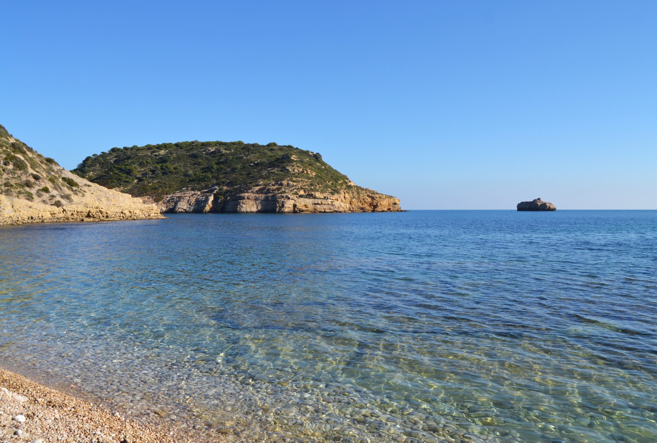
Cala del Portitxol is known to most people as a photograph: a low whitewashed hut with a bright blue door, turquoise water, an island sitting just offshore. The picture has done more for this cove’s visitor numbers than any tourist board ever could, and it is genuinely a lovely place to stand.
It is also, by a distance, the least interesting thing about the bay. In the summer of 2021, two holidaymakers free-diving here with their family noticed something glinting in a crack in the rock near the island. What they had found turned out to be one of the largest hoards of Roman gold coins ever recovered in Spain, and one of the largest in Europe. The seabed they were swimming over carries more than a hundred ancient anchors. This guide is about the cove you cannot photograph.
The 53 Coins in the Crack in the Rock
Luis Lens Pardo and César Gimeno Alcalá were snorkelling off the Illa del Portitxol in the summer of 2021 when they came across eight coins wedged into a small fissure. They did not, at first, understand what they were looking at. What they did next is the part everyone involved has since praised: instead of pocketing them, they took them to the town hall and the Museu Soler Blasco, which triggered the regional heritage protocol.
Archaeologists from the University of Alicante, working with the Guardia Civil’s specialist underwater unit and the town council, then dived the site properly. They brought up a total of 53 gold solidi, dated to the late fourth or early fifth century — the very end of the Western Roman Empire. Three carried the head of Valentinian I, seven Valentinian II, fifteen Theodosius I, seventeen Arcadius and ten Honorius. One could not be identified. They came up so well preserved that the inscriptions could be read. Alongside them were three nails, probably copper, and some badly degraded lead that may once have been part of a chest.
What the researchers make of it is the part worth carrying away, because it turns a pile of gold into a piece of history. Gold solidi were not everyday money; they were stored wealth, the thing you keep rather than the thing you spend. A hoard of them going into the sea intact, at this date, is read by the University of Alicante team as illustrating a moment of extreme insecurity: the violent arrival in Hispania of the Suebi, the Vandals and the Alans, and the definitive end of Roman rule in the peninsula from 409. Somebody concealed this, or lost it, at the point when the world it belonged to stopped working.
The Generalitat put up €17,800 for a full underwater excavation campaign, run by the team behind the ongoing archaeological survey of the Portitxol under the classical historian Jaime Molina. The coins went to the Institut Valencià de Conservació i Restauració, where the main problem turned out to be biological: fifteen centuries of marine polyps had cemented themselves to the gold. Electron microscopy identified the accretions as calcium, iron and trace elements, and the coins were cleaned in ultrasonic baths. Once restored, they came back to Xàbia and were deposited in the Museu Arqueològic i Etnogràfic Soler Blasco, in the old town. You can go and look at them, which is a rather better use of an hour than queuing for the blue door.
A Bay With a Hundred Anchors on the Floor
The coins were spectacular, but they were not an accident of geography. The Portitxol is a natural anchorage — a bay sheltered enough for a ship to ride out weather that would wreck it half a mile away — and ships have been using it for roughly three thousand years.
Surveys run since 2019 by the council, the University of Alicante and the Generalitat have identified more than a hundred anchors lying on the seabed around the island. In a single year, researchers catalogued twenty of them: one Phoenician, the rest Roman, Andalusi and later, running all the way to the nineteenth century. Anchor forms changed over time in ways that are datable, so the collection reads almost as a timeline of who was sailing this coast and when. Alongside them the surveys have recovered amphora cargoes, ceramics from several periods, and metalwork associated with ancient navigation.
An anchor left on a seabed usually means a ship that had to cut its cable and run. A hundred of them means a bay that sailors kept betting on, and sometimes lost. The council has floated the idea of an underwater museum here, which would make the bay legible to anyone with a mask rather than only to archaeologists.
The Island
The Illa del Portitxol sits roughly 300 metres offshore and gives the cove its name. It was declared a Bien de Interés Cultural in October 2018, for both its heritage and its landscape value — a process that had actually been started back in 1980 and had to be re-opened in 2022 over administrative problems.
It is a substantial archaeological site in its own right, with occupation documented from the end of prehistory through to the nineteenth and twentieth centuries. Its busiest period was late antiquity, the fourth and fifth centuries, which lines up exactly with the anchors and the coin hoard: this was a commercially active place at the moment the Roman west was coming apart.
One detail surprises most visitors. The island is privately owned, by the Pons family, who have collaborated with the excavations rather than obstructed them. The first archaeological dig on the island itself only began in October 2022, run by the Museu Soler Blasco and the University of Alicante’s heritage research institute under a four-year plan approved by the regional culture department, with funding from the council and the CIRNE Foundation. For a site catalogued since 1980, that is a long wait for a trowel.
What the Shore Is Actually Like
The cove sits between two very different headlands: Cap Prim to the north, Cap Negre to the south. The cliffs around the bay itself are made of relatively soft, easily eroded material, so they stay low and pile up fallen blocks along the waterline — grey and yellow rock against the blue, which is a large part of why the place photographs the way it does. Cap Negre at the southern end is limestone, and changes the scene entirely: sheer vertical walls dropping into the sea, riddled with caves and underwater fissures.
Underfoot there is no sand. The shore is gravel, pebbles and rounded stones, and water shoes are a requirement rather than a suggestion. The main stretch alongside the cottages runs about 200 metres and is only some 15 metres deep; the wider inlet between the two capes extends well beyond that. Toward the southern end, the seabed becomes large flat rock slabs split by narrow channels — people often describe them as submerged streets — and that is where the snorkelling is best, with urchins, octopus, crabs and fish easy to pick out.
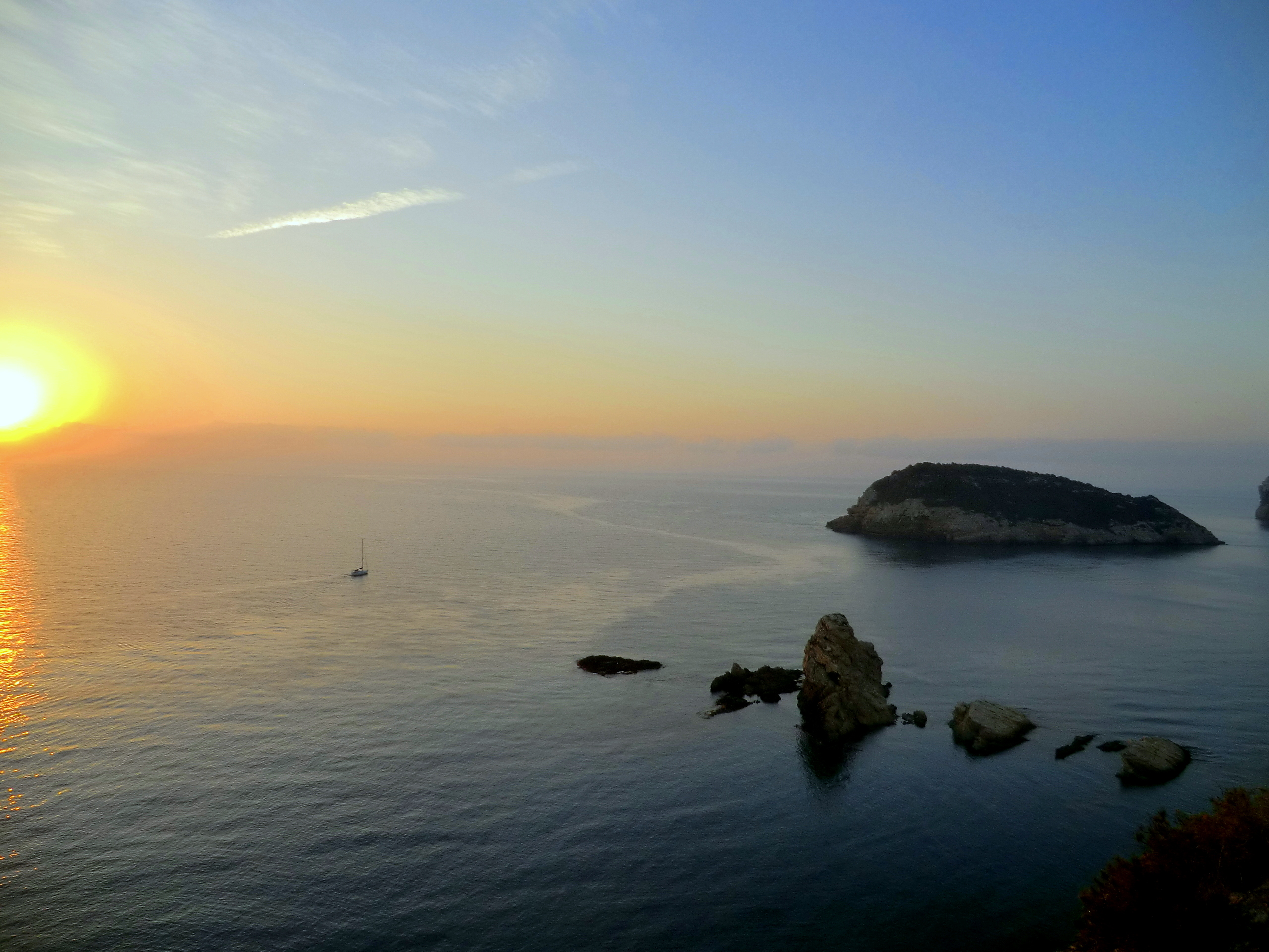
The land is protected too, and not many visitors realise it. In May 1999 the Valencian government established two flora microreserves here, one at Cap Prim and one at the Portitxol cove itself — small, strictly delimited areas set aside because of the plant communities they hold. Staying on the marked paths is not just good manners on this stretch of coast.
Getting There, and What It Now Costs
A great deal of what is written about parking at the Portitxol is out of date, including an earlier version of this page, which said the parking was free. It is not.
The cove is inside the same regulated access scheme Xàbia applies to Cala de la Granadella. Under the council’s published notice for 2026, paid regulated parking runs continuously from 2 June to 6 September, plus the weekends of 12–13, 19–20 and 26–27 September, charging from 9:00 to 19:00 at €9 per day per vehicle, payable at the meter or through the ELPARKING app. There are 59 spaces, on Carrer Barraca. Spaces cannot be reserved, and when the car park fills, a barrier closes the road. Live availability panels sit at the Consum roundabout and on Carrer Barraca, so you can find out before you drive down rather than after.
One further point that matters more here than at Granadella: the council states plainly that there is no public transport service to Portitxol–Barraca. Granadella gets a seasonal road train; this cove gets nothing. If the barrier is down, your options are to wait, to come back, or to walk in.
Walking in is the option most regulars take. Park at the Mirador de la Creu del Portitxol, up on the coast road, and take the signposted SL-CV 97 trail down — roughly 700 to 800 metres through pine and old terraced ground, easy enough for children. It sidesteps the parking lottery entirely. The return climb in August heat is the price, so carry water and do it early or late.
In the Water
Snorkelling over the rock slabs at the southern end is the best free thing to do here. Diving operators work the island, with routes reaching about 21 metres on the more advanced dives. Kayaks and paddleboards can be hired at the cove, and paddling out is the sane way to see the island up close: swimming the 300 metres unaccompanied puts you in among boat and jet-ski traffic with no protection at all.
From the cove, kayak routes run north around Cap Prim toward Cala Sardinera, and south under the vertical walls of Cap Negre with their sea caves and fissures. Guided trips are common and worth taking if you want the caves, since the swell inside them changes fast.
There is a rule here that most beach guides never mention. This bay is a protected archaeological zone under active survey. If you find something on the seabed — and people plainly do — the legal and sensible course is the one Lens and Gimeno took: leave it in place, note where it is, and report it to the town hall or the Museu Soler Blasco. Removing archaeological material from a protected site is an offence, and it also destroys the context that makes a find worth anything to anyone.
Eating and Staying Around the Cove
For a cove this small, having two proper restaurants on site is unusual. Cala Clemence has the larger terrace and runs from breakfast through to dinner; La Barraca, at the far end of the shore, does a more traditional local menu built around rice and fresh fish. Both fill up in season, and the walk to La Barraca along the stones is part of the appeal rather than a chore.
There are no hotels at the cove. Accommodation nearby is villas and holiday rentals, concentrated around the Balcón al Mar development on the slope above. For hotels you want Xàbia town, a few kilometres away, which also puts you within walking distance of the Soler Blasco museum and the coins. Our ranking of the best beaches in Alicante covers how the Marina Alta coves compare if you are planning to string several together.
When to Go
Two things decide the timing here, and neither is water temperature.
The first is the access calendar. Outside the barrier season — before June and after the last September weekend — you drive down, park for nothing, and may have the place close to yourself on a weekday. October is the standout: the sea is still warm, the charge is off, and the light is better for photographs than the flat glare of August.
The second is the wind. The cove is sheltered by the island to seaward and by Cap Negre to the south, so under normal conditions the water is flat. An easterly Levante changes that quickly, pushing swell straight into the bay and turning the snorkelling over the rock slabs from pleasant to unwise. It is worth a look at the forecast the night before rather than the morning of.
If the blue door is genuinely why you are coming, accept that you are competing with everyone else who saw the same photograph and go at first light. By ten on an August morning there is a queue, and the cottages are private property regardless of how many people are pointing phones at them.
Map
Frequently Asked Questions
Why is it also called Cala de la Barraca?
After the barracas, the traditional fishermen’s huts along the shore. The council uses both names, and the parking street is Carrer Barraca, so it is worth recognising both when navigating.
Can you land on the Illa del Portitxol?
It is privately owned by the Pons family and is a protected archaeological site under active excavation, so it is not a place to go ashore uninvited. Paddling or diving around it is the normal way to see it.
Access dates, prices and parking arrangements quoted here come from the Ayuntamiento de Xàbia’s published notice for the 2026 season and are given for information only; they are revised annually and should be confirmed at ajxabia.com before travelling. The shore is loose stone and the submerged rock slabs are slippery. The bay is a designated archaeological zone and the surrounding land includes protected flora microreserves — removing archaeological material or leaving marked paths carries legal consequences as well as environmental ones. The fishermen’s cottages are private homes, not an exhibit. Swimming to the island is not advised because of boat and jet-ski traffic.
Sources
Checked on 27 August 2026.
- The coin hoard. Universitat d’Alacant — announcement of the find, September 2021. Source for the 53 solidi, their analysis by the university’s Institut Universitari d’Investigació en Arqueologia i Patrimoni Històric, the late Roman dating to the end of the fourth or beginning of the fifth century, the state of preservation that allows the inscriptions to be read, and the full breakdown by emperor: three Valentinian I, seven Valentinian II, fifteen Theodosius I, seventeen Arcadius, ten Honorius and one unidentified. Also the source for the chance discovery of eight coins by Luis Lens and César Gimeno, which triggered the regional heritage protocol, and for the researchers’ reading of the hoard against the arrival of the Suebi, Vandals and Alans and the end of Roman rule in the peninsula from 409.
- The anchors and the survey. The same announcement records the bay as an area known for the abundance of underwater archaeological remains under study — anchors, amphora cargoes, ceramics of several periods, metalwork and elements associated with ancient navigation — recovered through surveys promoted jointly by the Ajuntament de Xàbia, the university and the Generalitat since 2019, and names the general research plan for underwater archaeology in the Portitxol under which the excavation campaign was run.
- The access regime. Ajuntament de Xàbia — Acceso a calas and the tourism portal’s Playas seguras notice. Source for the regulated period of 2 June to 6 September plus the September weekends, the 9:00 to 19:00 hours, the €9 daily charge, the impossibility of reserving, the 59 spaces on Carrer Barraca, the availability panels, the closure of the road by barrier when the car park fills, and the explicit statement that there is no public transport service to Barraca. Motorbikes and reduced-mobility vehicles are exempt from the charge but must use the designated area.
- What we corrected earlier. A previous version of this guide said the parking here was free. It has not been since the regulated scheme was extended to this cove, and the error is noted rather than quietly overwritten.
- Protection of the seabed and the land. Archaeological material in Spanish waters is protected cultural heritage; removing it is an offence and it destroys the context that gives a find its meaning. The Posidonia oceanica beds along this coast are a priority habitat of community interest under the EU Habitats Directive, and since 13 March 2026 Real Decreto 191/2026 has set a general prohibition on anchoring over them across the Spanish Mediterranean — relevant to the boats and dive operators working the island.
- What we could not verify. The €17,800 figure for the Generalitat’s excavation campaign; the October 2018 declaration of the island as a Bien de Interés Cultural and the reopening of the procedure in 2022; the establishment of the two flora microreserves in May 1999; the private ownership by the Pons family and the October 2022 start of the first dig on the island; the SL-CV 97 waymarking and the 700 to 800 metre length of the path from the Mirador de la Creu; and the dive depth of about 21 metres. These come from council, museum and press material rather than from a register we could link to, and the island’s ownership in particular should not be treated as an invitation.
- If you find something. Leave it where it is, note the position, and report it to the Ajuntament de Xàbia or the Museu Arqueològic i Etnogràfic Soler Blasco. That is what Lens and Gimeno did, and it is the reason the hoard is in a museum rather than dispersed.
Image Credits
- Header image: Illa del Portitxol i l’escull de sant pere o Bergantí des de la Barraca by Joanbanjo, licensed under CC BY-SA 3.0, via Wikimedia Commons.
- In-article image: Bonito amanecer desde el Portixol by Isabeau Ottolini, licensed under CC BY-SA 4.0, via Wikimedia Commons.
Leave a Reply