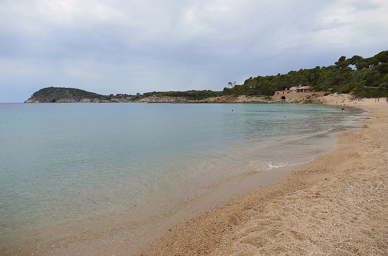
On 12 June 1994, 6,001 people in Palamós walked into a polling station and were asked whether the beach at Castell should be built on. Nearly seven in ten — 4,189 votes, 69.81 per cent — said no. That is why there is a pine wood behind this beach instead of four hundred houses, a hotel and a golf course, and it is why Castell is routinely described as the last large undeveloped beach on the Costa Brava. Every other beach on this coast lost that argument, mostly without ever having it. It is worth being clear about what the vote did and did not do: the sand itself was already public under the Ley de Costas, as all Spanish beaches are. What Palamós voted on was the land behind it — which is almost always what actually decides whether a beach stays as you find it.
The Vote That Made This Beach
Castell had been protected land under a municipal plan dating back to 1959. Then, between 1985 and 1990, Palamós drafted a new general plan, and in it the beach and the flat farmland behind it changed status: from rural land to land programmed for development. Two companies, El Castell SA and Camo SA, brought forward projects. The figure attached to the referendum question was 389 dwellings, a hotel and a golf course. The breakdown reported since does not add up to it: accounts describe a hundred detached houses and a hotel on the flat land, plus a further hundred and eighty among the pines, which leaves a hundred unaccounted for. We have not been able to reconcile the two figures and have not picked one — see the sources at the foot of this page. The promoters sold the scheme, in the language of the era, as low-density development that would bring jobs and investment, and argued it would reduce the fire risk on abandoned land. An earlier approach from Club Méditerranée had already put the place on people’s radar.
In 1992 a group of residents formed a platform called Salvem Castell. What followed was two years of public meetings, scale models on both sides and a genuinely rough campaign — the promoters had money and the ecologists had volunteers. The platform gathered 13,124 signatures, in a town whose electoral roll ran to 10,826, and put them to the administration demanding the land be reclassified and protected. In 1993 the council voted a resolution to put the question to a referendum. Cornered between the two sides, it had done something almost nobody does with a planning decision: handed it back to the town.
The ballot paper asked, in Catalan, whether the residents wanted Castell — the paratge and the plana — to be developable. It was held on the same day as the European Parliament elections, which is how a municipal consultation got a 56.5 per cent turnout from a census of 10,826. The result was not legally binding on anyone. The mayor of the day, Josep Ferrer, leading a council with a CiU majority, had committed to respect it regardless. Against the 69.81 per cent who voted no, 26.25 per cent voted yes. Three days later, on 15 June, an extraordinary plenary session voted unanimously to open the procedure to modify the general plan and reclassify the plana and the paratge as non-developable land.
That was not the end of it. The promoters appealed, and the case went up through the Catalan high court and finally to the Supreme Court, which confirmed Castell as non-developable. The Generalitat eventually bought out the landowners. The beach and its hinterland now sit inside the Pla Especial Castell–Cap Roig, and the fight itself became a reference point for every Costa Brava conservation campaign since.
If you want to see what the alternative looked like, you do not have to imagine it. Walk twenty-five minutes south along the coastal path to La Fosca, the next beach along, and look at the apartments.
What the Beach Is Like
Big, by the standards of this coast: somewhere between 300 and 375 metres of shoreline depending on who is measuring and how the winter has treated the sand, and 40 to 90 metres deep. It is a clean crescent closed by rock at both ends, with the mouth of the Riera d’Aubi arriving at roughly the middle.
The sand is fine and golden and the slope into the water is gentle — the opposite of the gravel and sudden drop that characterises most of the coves in Begur and Tossa further north. That, plus the size, is why Castell is a genuine family beach rather than a beautiful cove you can barely fit on.
What it does not have is buildings. Behind the sand there is pine, farmland and a few masies, and the services are deliberately minimal and seasonal: lifeguard cover in summer, showers, chemical toilets, ramps, a kayak school and a chiringuito or two. Nothing permanent, nothing in concrete. Bring shade — there is very little of it once you are on the sand.
The bay faces south, which shelters it from the tramuntana but leaves it open to southerlies. In summer those tend to build from around midday, so the flat, clear water is a morning phenomenon here. Early swimmers get visibility good enough to see fish and the seagrass offshore; by four in the afternoon on a windy day it is chop and cloudy water.
That seagrass has become the next argument about this stretch of coast, and it is worth knowing about because it is the same argument as the referendum in a different medium. Since 13 March 2026, Real Decreto 191/2026 has set a common framework for conserving marine phanerogam meadows across the Spanish Mediterranean, with a general prohibition on anchoring over Posidonia oceanica and Cymodocea nodosa. Conservation groups on the Costa Brava spent the summer of 2026 arguing publicly that it is not being enforced, and the example they reached for was this one: boats anchored over mapped meadows inside the Castell–Cap Roig protected space. Their point was that this is not an obscure corner where nobody knows what is on the bottom — the meadows here are surveyed and the space is protected. Thirty years after the town saved the land, the pressure has moved offshore.
The Iberian Town on the Headland
On the rocky promontory closing the north end of the beach sit the walls of an Iberian settlement, built in the sixth century BC and occupied into the Roman period. Its people were the Indigetes, and the position on a small peninsula gave them command of the coast and a place on the trade routes running out of the Greek city of Empúries. They were doing much what the modern town does: fishing and trading along this shore. The site covers around 5,000 square metres, and the director of the Museu d’Arqueologia de Catalunya’s Ullastret headquarters has put the population at its height at roughly two hundred — an approximation, he is careful to say, because a significant part of the settlement has never been dug. It was declared a cultural asset of national interest in 1996.
It was rediscovered in 1935 by Lluís Barceló i Bou, curator of the Museu Cau de la Costa Brava — the institution that became the Museu de la Pesca down in the port. The excavations came later, running through the 1940s and 1950s, and further campaigns of digging and restoration followed the 1996 declaration. What has come out of the ground is domestic rather than monumental, and better for it: the wall, the houses, the street grid that organised the place, cisterns cut for water and pits cut for grain, Emporitan grey ware and Campanian pottery, Greek imports, and a small sheet of lead carrying one of the longest Iberian inscriptions found anywhere in Catalonia.
Check that it is open before you climb up, because this is not a site you can assume. Storm damage and the risk of landslips closed it to visitors for years, and only the lower platform was reopened, in October 2024, timed to coincide with the European Heritage Days. Within weeks somebody vandalised the settlement’s main cistern, tearing stone blocks out of the circular structure and the walls beside it and throwing them into the bottom — damage the Museu d’Arqueologia de Catalunya, which manages the site, put at more than five thousand euros and reported to the Mossos d’Esquadra and the Agents Rurals. What is accessible at any given moment is a live question, and the MAC is the place to ask it.
If it is open, go up in the late afternoon. It is a five-minute climb from the sand, the view back down the crescent is the best one there is of this beach, and standing on a two-and-a-half-thousand-year-old wall looking at an undeveloped shoreline is a fairly pointed way to spend ten minutes.
The Coast on Either Side
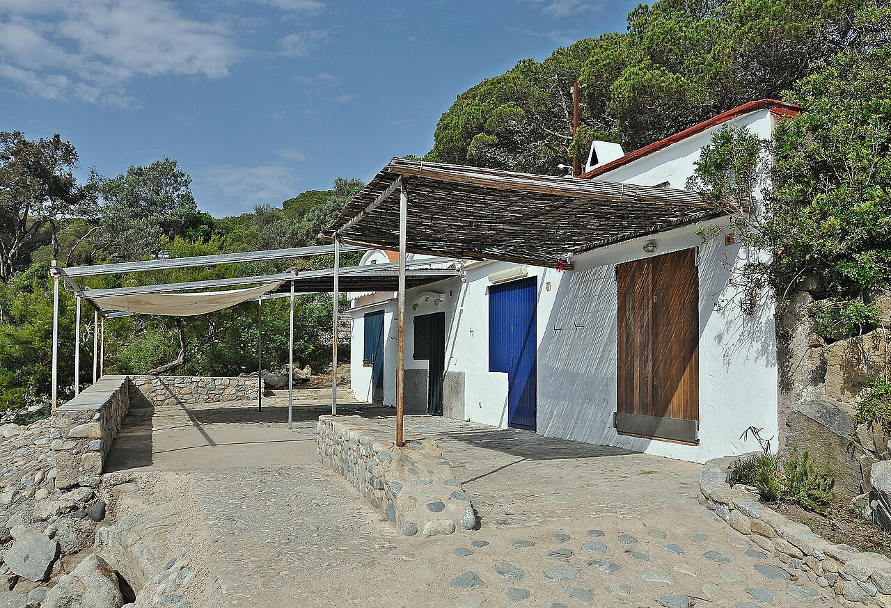
South of the beach, a short walk brings you to Cala s’Alguer, a fishing hamlet of low barraques painted in blocks of colour, now used as seasonal houses and protected as a cultural asset of national interest. It is one of the few surviving pictures of what this coast looked like before tourism, and it survives partly because people fought for that one too.
North, past the Iberian site, the path reaches Cala Foradada — a small, very clear cove with a sea cave that a kayak can paddle straight through. Keep going and the camí de ronda runs on towards Cala Estreta, the Cap Roig gardens and eventually Calella de Palafrugell. This is one of the finest walking stretches on the whole Costa Brava, shaded for much of the way, and the kayak school on the beach exists largely because the coastline either side of Castell is best seen from the water.
How to Get to Platja de Castell
By Car
From the AP-7, take exit 6 and follow the C-255 towards La Bisbal d’Empordà, then on towards Palamós and the signs past Camping Benelux. The car park is paid in season and sits about five minutes’ walk back from the sand — a deliberate arrangement, since the whole point of the place is that nothing was built next to the beach.
On Foot from La Fosca
The standard local move: park in the streets at La Fosca, if you can find a space, and walk the camí de ronda round in about twenty-five minutes. It is mostly shaded, it costs nothing, and it takes you past the ruins of the Castell de Sant Esteve de Mar on the cliff. It also means you arrive having seen exactly the thing Castell was saved from.
Map
Eating and Sleeping Nearby
On the beach: seasonal chiringuitos, drinks and casual food, enough to get through a day without leaving. That is all there is and all there is going to be.
For a proper meal you go into Palamós, which is not a hardship. This is a working fishing port with a daily auction and a museum of fishing attached to it, and its prawns — gamba de Palamós — are the most famous single ingredient on this coast, with prices to match. Eating them within sight of the boats that landed them is the correct way to end a day at Castell.
Nobody sleeps at the beach, because there is nowhere to sleep. Palamós has the hotels and apartments; La Fosca is the closest developed base and puts you twenty-five minutes away on foot.
When to Go
Castell’s problem now is its own reputation. A beach with no development, no promenade and a small car park has a hard ceiling on how many people it can absorb, and thirty years after the referendum it is being loved fairly hard — high on every online list, packed on August weekends, and with the arrival capacity of a place that was deliberately never built up. The people who saved it say so themselves.
So: June and September, on a weekday, are what this beach is for. Warm water, space on the sand, and the walk to the Iberian site or on towards Cap Roig without queueing for it. In July and August, come early — before ten for the car park, and before midday for the flat water.
Out of season it is arguably better still, if you are walking rather than swimming: pine, empty sand, archaeology and no chiringuito. For how Castell sits against the rest of the region, see our Costa Brava beach rankings.
Practical Tips
- Bring shade and water. No promenade, no permanent buildings, very little natural cover on the sand.
- Swim in the morning. The southerly typically gets up around midday and takes the clarity with it.
- Walk in from La Fosca. Twenty-five shaded minutes, free, and it sets up everything the beach is about.
- Check the Iberian site is open, then give it twenty minutes. A short climb at the north end and the best viewpoint over the bay — but access has been restricted since storm damage and only part of it reopened in 2024.
- Take your rubbish out with you. This is protected land with minimal servicing — what you leave, stays.
Written for general information, not as travel, legal or safety advice. Castell sits inside a protected area with deliberately minimal infrastructure: services, toilets and lifeguard cover are seasonal and can be absent entirely outside summer, and there is little shade. The bay is exposed to southerly wind, which typically builds through the afternoon. The Iberian settlement is a protected archaeological site — stay on the marked routes and remove nothing. Confirm current details with the Ajuntament de Palamós before travelling.
Sources
Checked on 27 August 2026.
- The referendum figures. Reported in detail by the Girona daily El Punt Avui in its thirtieth-anniversary account of the vote: 12 June 1994, 6,001 voters, 56.50 per cent of a roll of 10,826, and 69.81 per cent against — 4,189 people. The same paper’s twenty-fifth-anniversary piece gives the yes vote as 26.25 per cent, names the mayor as Josep Ferrer of a CiU-majority council, and records the unanimous extraordinary plenary three days later. These are press accounts; the municipal record itself is held in the Arxiu Municipal de Palamós, which exhibited the Salvem Castell papers for the anniversary.
- The ballot question and the campaign. The question put to voters asked whether Castell — paratge and plana — should be developable. Documented, with the 13,124 signatures and the 15 June plenary motion, in an account drawing on the Salvem Castell archive.
- A figure we have not reconciled. The scheme is given as 389 dwellings plus hotel and golf course in accounts tied to the referendum question, but the breakdown reported elsewhere — a hundred detached houses and a hotel on the plana, a hundred and eighty more among the pines — comes to 280. Both figures appear in the same newspaper’s coverage in different years. We have published both rather than choosing.
- The Iberian settlement. Museu d’Arqueologia de Catalunya, which manages the site through its Ullastret headquarters, records it as built in the sixth century BC, inhabited by the Indigetes, and positioned on the trade routes around Empúries. The 5,000 square metres and the estimate of around two hundred inhabitants come from the MAC’s Ullastret director, quoted in Catalan radio coverage of the 2024 reopening. The 1935 rediscovery by Lluís Barceló i Bou, the 1996 national declaration and the later excavation campaigns are recorded in the same coverage.
- The closure and the vandalism. Reported by Catalan public media and press in October and November 2024: the site closed after storms brought landslide risk, the lower platform reopened on 11 October 2024 for the European Heritage Days, and the main cistern was deliberately damaged within weeks, at a cost the MAC estimated above €5,000, reported to the Mossos d’Esquadra and the Agents Rurals. Sources disagree on how long the closure lasted — one gives three years, another dates it from 2019. We have not resolved that and have written it as “for years”.
- What we removed. An earlier version of this guide gave the settlement two square towers, 64 storage pits and two cisterns, dated the occupation to the first century AD, and attributed the excavation to Barceló i Bou. We could not stand any of those up against the museum’s own material, and the abandonment is dated by the MAC’s account to the first century BC rather than AD. The specific counts have been replaced with what the register describes.
- The seagrass and the anchoring rule. Real Decreto 191/2026, de 11 de marzo, Boletín Oficial del Estado of 13 March 2026, article 5. Posidonia beds are a priority habitat of community interest under the EU Habitats Directive. The claim that the decree is not being enforced over the mapped meadows at Castell–Cap Roig is the stated position of Costa Brava conservation organisations during the summer of 2026, reported in the Catalan press; we give it as their position and not as an established finding, and we have found no official assessment of compliance.
- Measurements and municipal services. Beach dimensions from the Guía de Playas of the Ministerio para la Transición Ecológica y el Reto Demográfico (Fuente: © Ministerio para la Transición Ecológica y el Reto Demográfico), given as ranges because published figures differ and because a sand beach behind no sea wall genuinely changes between winters. Parking, lifeguards and seasonal facilities are set by the Ajuntament de Palamós under article 115 of the Ley 22/1988 de Costas.
- Still unverified. The 1959 municipal plan said to have protected Castell before the 1980s revision; accounts variously date the replacement general plan to 1986, to a 1985–1990 drafting period, and to 1992. We have kept the drafting period and flagged the disagreement here. Also unverified against a register: the national-interest listing of the barraques at Cala s’Alguer.
Image Credits
- Header image: Platja el Castell 05 by Kritzolina, licensed under CC BY-SA 4.0, via Wikimedia Commons.
- In-article image: Barracas de cala Pallerida by Alberto-g-rovi, licensed under CC BY-SA 4.0, via Wikimedia Commons. Shows the barracas at cala Pallerida, not Platja de Castell.
Leave a Reply