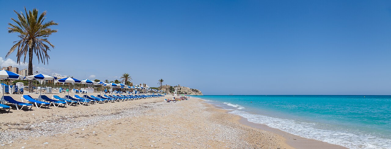
Beaches on this coast tend to be either small and hard to reach or long and completely built up. Playa Paraíso is neither: over a kilometre of pebbles and sand at the southern edge of Villajoyosa, with a clifftop hotel at one end, an Iberian sanctuary on the hill behind it, and a tram stop close enough to make a car optional.
It is popular, particularly with a younger crowd, but its length does the work: a beach of well over a kilometre simply does not fill the way a cove of 100 metres does. For the opposite experience on the same municipality’s coastline, Racó del Conill is small, wild, and naturist.
Where Is Playa Paraíso?
At the southern end of Villajoyosa (La Vila Joiosa), province of Alicante, beside the Hotel Montíboli, about a kilometre beyond the town’s urban centre on the road toward Benidorm and Finestrat. Also written Platja Paradís, or simply El Paraíso.
It has good neighbours. A short cliff separates it from Cala Bol Nou immediately south — usually described as Paraíso’s smaller sister — and a little further along sit L’Esparrelló and La Caleta, both reached through the Montíboli grounds.
What the Beach Is Actually Like
Long, and the figures vary: the published lengths run from roughly 1,060 metres to 1.5 kilometres, because nobody agrees where this stretch of coast ends, at 25 to 30 metres wide. The shore is rounded pebbles with patches of sand mixed through — comfortable enough to lie on, awkward enough to walk into the water on. Water shoes solve it.
The water is clear, turquoise and generally calm, sheltered from the worst of the currents, and the beach holds Blue Flag status. A rockier stretch toward one end gives the only real snorkelling; the open central section is pebbles and not much else underwater.
Lifeguard cover in season, wooden walkways over the stones, foot-washing points, and adapted access from the promenade in some sections. Two chiringuitos operate on the sand, but neither has a full kitchen — this is a bring-your-own-cooler beach, and most regulars treat it that way. Pets and motorhomes are not permitted.
In and On the Water
A local operator rents kayaks and paddleboards from the beach in season, and is reported to run a full-moon paddle in summer that goes out in front of the Montíboli — we have not confirmed the season, the price or the dates with the company — the kind of thing that sounds like a gimmick until you are on the water at night looking back at a lit-up cliff.
Otherwise the calm water and the beach’s length make it a straightforward place to swim, which is more than can be said for several of the coves further north on this coast.
Walking South: Bol Nou and the Montíboli Coves
The rocky outcrop closing the southern end of Paraíso is the boundary with Cala Bol Nou, and getting over it is the start of the best walk here. Past Bol Nou lie L’Esparrelló and La Caleta, both small, both reached through the Hotel Montíboli grounds, and both considerably quieter than the main beach.
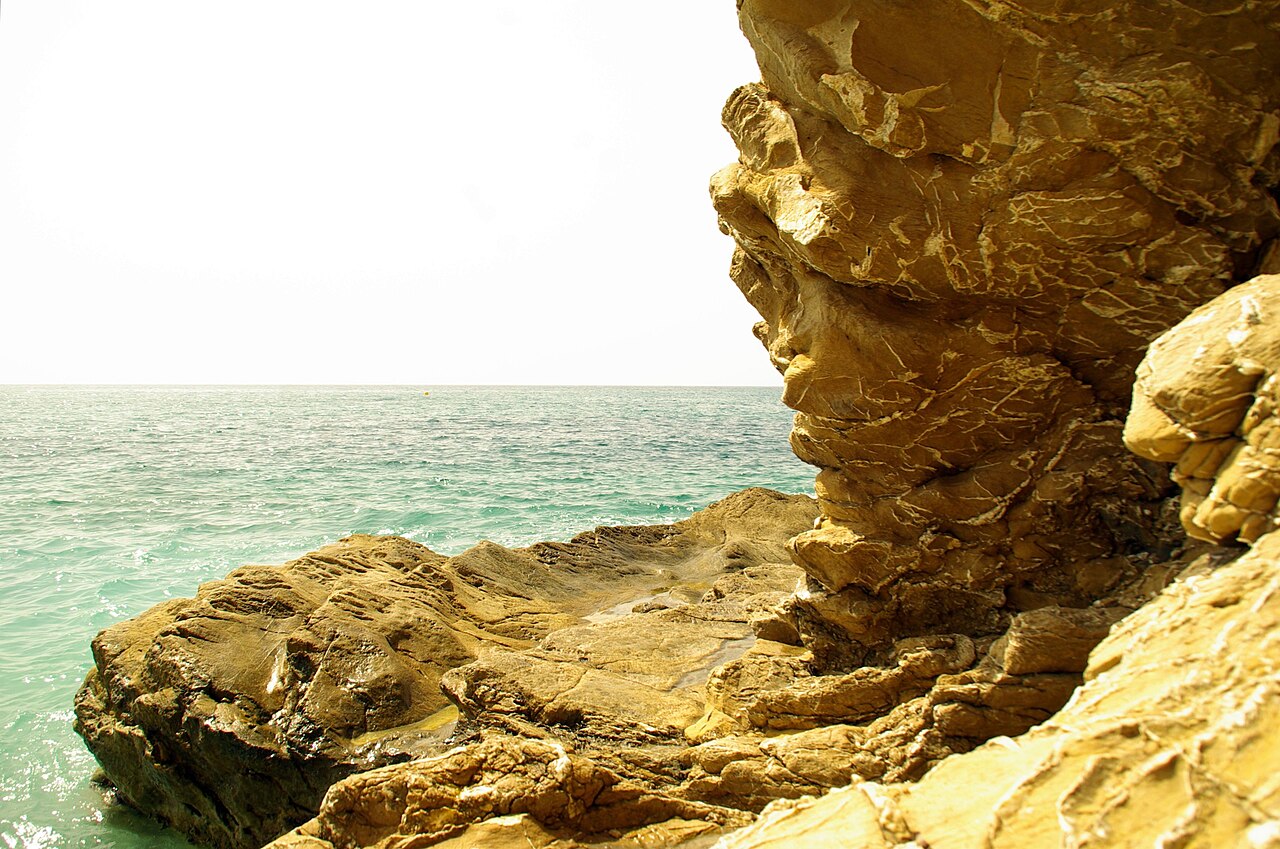
Four distinct beaches within a short walk of each other is unusual on this coast, and it is the strongest argument for spending a whole day here rather than an afternoon.
The Hill Behind the Beach
Inland from the sand rises La Malladeta, and there is a great deal more on it than the beach suggests. The summit of that promontory was a sanctuary for roughly five centuries — an Iberian one first, later a Roman one — and it is one of the more significant archaeological sites on this part of the coast.
It was built between about 375 and 350 BC, on a hilltop that commands the coast, the mouth of the Amadorio and the island of Benidorm. Excavation has turned up terracotta votive offerings, perfume burners and other material from ceremonies probably dedicated to a female divinity. Around 100 BC a major rebuilding levelled what stood there and raised series of rooms on terraces — nine found on the eastern slope, five on the western, with a great deal still unexcavated.
The end of it has a date and a reason. The terraced rooms were abandoned around 25 BC, though some kind of temple continued on the summit. Then, in AD 73 or 74, the emperor Vespasian granted the Roman city here — Allon — the status of municipium, making it the ninth and last Roman city in what is now the Valencian Community and the capital of the territory of the Marina Baixa. The sanctuary was abandoned completely around AD 80, and the sacred image and its cult were most likely moved down to a temple in the new forum. Those forum ruins lie under the present Plaza de la Generalitat in the town centre.
The hill was excavated in five seasons between 2005 and 2009 by an international team — the University of Paris, the CNRS, the University of Alicante and Villajoyosa’s own museum service — funded largely by the French foreign ministry, and the results were published through the Casa de Velázquez.
The Island Was the Calendar
The detail that makes this worth the climb rather than merely worth reading about is what the sanctuary was looking at.
Archaeoastronomical work by Villajoyosa’s museum service, published in the Archivo Español de Arqueología, photographed the sunrise from the summit on the significant dates of the solar year. The island of Benidorm, sitting out to the north-east, appears to have functioned as a precise marker — of the equinoxes, or more probably of the day midway between the solstices. On that date the sun comes up strikingly over the island’s southern slope. And several of the few walls surviving in the core of the sanctuary, the area where rituals involving fire were carried out, are aligned towards the islet.
So the thing you can see from a towel on Playa Paraíso may well be the reason the sanctuary is where it is.
The 19th-century tower on the summit — the one you can see from the beach — stands where that last temple stood. It belonged to José María Esquerdo, the Villajoyosa-born physician and a founding figure of Spanish psychiatry, who has streets named after him across the country, including in Madrid. It is generally understood to have replaced an earlier coastal watchtower of the kind built all along this coast against Barbary raids. Below it stands Villa Giacomina, the ornate house known locally as the palacete, which is Esquerdo’s too and is in poor condition.
Three layers of the same hilltop, then, chosen for the same reason each time: a temple, a lookout, and a doctor’s retreat, all of them there because of what you can see from it.
It is a short detour uphill, and the views back over the coastline are the practical reward if the history is not your thing.
Getting There
By tram, Line 1 of the TRAM Metropolitano de Alicante has a stop called Paradís within easy walking distance — which puts this beach within reach of Alicante, Benidorm and everything along the line without a car. It is one of the more useful facts in this guide and one most visitors do not know.
By car, take the N-332 south from Villajoyosa and the “Villajoyosa Sur” exit, which leads straight down. Parking is unguarded with over 100 spaces; on a summer weekend, arrive early anyway.
Eating and Staying
The two chiringuitos handle drinks and light food and no more. For a proper meal, the Hotel Montíboli is next door, and Villajoyosa’s centre — a serious seafood town, known for arròs a banda — is a short ride away.
Three quite different options for staying. The Hotel Montíboli sits on the clifftop with its own coves below it. Camping Playa Paraíso is on the beachfront itself and is the budget, family end of the range. And Villajoyosa’s town centre, with its painted seafront houses, gives the widest choice of hotels and apartments and is also the better base for reaching Racó del Conill north of town.
When to Go
Water here runs from around 14–17°C in winter to 26–27°C in August, which is the normal curve for this coast. What is not normal is how little the calendar matters: on a beach this long, the crowds spread out, and July on Paraíso feels closer to June on most coves nearby.
Summer brings the warmest water, the kayak rentals, and the liveliest atmosphere, and parking is the only real pressure point — the sand absorbs the visitors, the car park does not. Spring and autumn are quieter and better suited to the full version of a day here: swim, walk south over the outcrop to Bol Nou and the Montíboli coves, climb up to La Malladeta. In winter the swimming stops, but that walk is at its best, and the beach is essentially empty.
Practical Tips
- Water shoes. Rounded pebbles all the way to the waterline.
- Bring a cooler. Neither chiringuito has a full kitchen, and everyone here knows it.
- Take the tram. The Paradís stop on Line 1 removes the parking problem entirely.
- Walk south. Bol Nou, L’Esparrelló and La Caleta are all within reach on foot, and all quieter.
- Go up the hill. The Iberian sanctuary and Esquerdo’s tower turn a beach day into something with a bit more to it.
Tram schedules, chiringuito openings, lifeguard season and access through the Hotel Montíboli grounds to the neighbouring coves are all subject to change and are not guaranteed; the Ayuntamiento de Villajoyosa is the authority to check before travelling. La Malladeta is a protected archaeological site — the excavated areas are not open ground to walk over.
Sources
Checked on 30 August 2026.
- The sanctuary. Vilamuseu, the museum and monuments network of the Ayuntamiento de Villajoyosa, which manages the site: the phases of occupation, the rebuilding around 100 BC, the nine rooms found on the eastern slope and five on the western, the abandonment of the terraces around 25 BC and of the summit around AD 80. The five excavation seasons between 2005 and 2009 were run by a Franco-Spanish project involving the Maison René Ginouvès, the CNRS, the University of Paris, the University of Alicante and Vilamuseu, funded largely by the French foreign ministry, and published through the Casa de Velázquez.
- The alignment with the island of Benidorm. Antonio Espinosa Ruiz (Vilamuseu), “El equinoccio en el ritual ibérico. El santuario de La Malladeta”, Archivo Español de Arqueología, published by the CSIC. The study photographed sunrises from the summit across the solar year and concluded that the islet served as a marker for the equinoxes or, more probably, for the day midway between solstices, and that several walls of the ritual core are aligned towards it.
- A correction made in August 2026. This guide previously described the tower on the summit as having been built for scientific observation. We have not found support for that. What the sources say is that it belonged to Dr Esquerdo — a torre-oficina on his estate, alongside the house known as Villa Giacomina — and that it probably replaced an earlier coastal watchtower. The guide now says that instead.
- Beach services, lifeguard season and access through the Hotel Montíboli grounds to the neighbouring coves are set locally and change; the Ayuntamiento de Villajoyosa is the authority to check. The published length of the beach varies between sources, which is why this guide gives a range rather than a figure.
- The Blue Flag. Administered in Spain by ADEAC, which publishes the list of awarded beaches (PDF). It is a voluntary certification the town hall applies for, not a public designation, and the 2026 round runs for two years rather than one. Our guide to what the award measures sets out what it does and does not tell you.
- What we have softened, on 30 August 2026. This guide said Dr Esquerdo introduced neuropsychiatry to Spain. He was unquestionably one of the founding figures of Spanish psychiatry, and that is what the guide now says; the stronger claim is the kind of statement about a named person that we do not publish without a source behind it. We have also stopped presenting the kayak operator’s full-moon paddle as though we had checked it, because we have not spoken to the company.
Image Credits
- Header image: Playa Paraíso, Villajoyosa — Diego Delso, delso.photo, License CC BY-SA 3.0, via Wikimedia Commons.
- In-article image: Villajoyosa, Playa Paraíso by Concepcion AMAT ORTA, licensed under CC BY 3.0, via Wikimedia Commons.
Leave a Reply