There is a waterfall on this coast that drops fifteen metres straight into the Mediterranean. You cannot walk to it. You cannot see it from the beach. And in high summer it sometimes isn’t running at all, because the water that feeds it has been diverted to irrigate the fields above — which is a very Maro sort of detail, and the thread this whole guide hangs on.
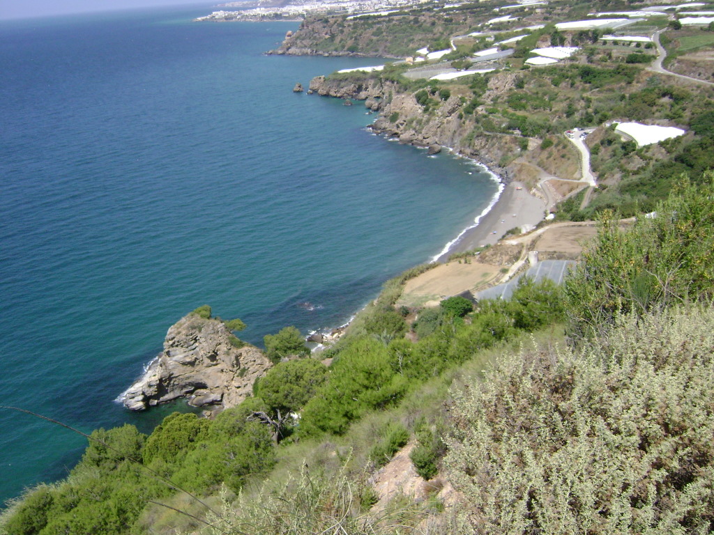
Playa de Maro is the main beach inside the Acantilados de Maro-Cerro Gordo, a protected strip of cliffs running roughly twelve kilometres from Nerja across the provincial boundary and into Almuñécar, in Granada. It is one of the few stretches of the Costa del Sol never built on, and it is close enough to Nerja that you can be swimming in clear, fish-filled water twenty minutes after leaving a promenade lined with hotels.
The Waterfall, and the Sugar Mills That Explain It
The Cascada Grande de Maro falls into the sea just east of the beach, reachable only from the water. Kayaks and paddleboards are rented on the sand and guided trips generally run two to three hours, taking in the waterfall, the sea caves and several of the coves along the cliffs. It is the single most popular thing to do here, and worth booking ahead in summer.
What is less often explained is why the flow varies so much. This valley was sugar-cane country for centuries, and the water coming down off the Sierra Almijara was a working resource long before it was scenery. The Acueducto del Águila, the four-tiered brick aqueduct standing above the village, was built in 1879 to carry water to the San Joaquín sugar mill down the road. The cane is gone and the land is under greenhouses now, but the irrigation system it was built to feed is still in use — which is why the waterfall can be a torrent in spring and a trickle in August.
So if the falls are the reason you are coming, come in spring, and check what the water is doing before you pay for a tour.
The Beach Itself
Around 500 metres of coarse, dark sand in a shallow curve, with cliffs rising behind it to seventy-five or eighty metres where the Sierra de Tejeda y Almijara runs out into the sea. The water is turquoise, unusually calm because the headlands block most of the swell, and clear enough that visibility is the main reason people come with a mask.
Unlike the protected beaches in Almería, Maro is not stripped of amenities: there are showers, a chiringuito doing pescaíto frito and the rest of the standard Andalusian repertoire, and the kayak rental operation. It is a protected beach with a bar on it, which makes it a considerably softer proposition than somewhere like Cabo de Gata — and part of why it gets busy.
The Coves Along the Cliffs
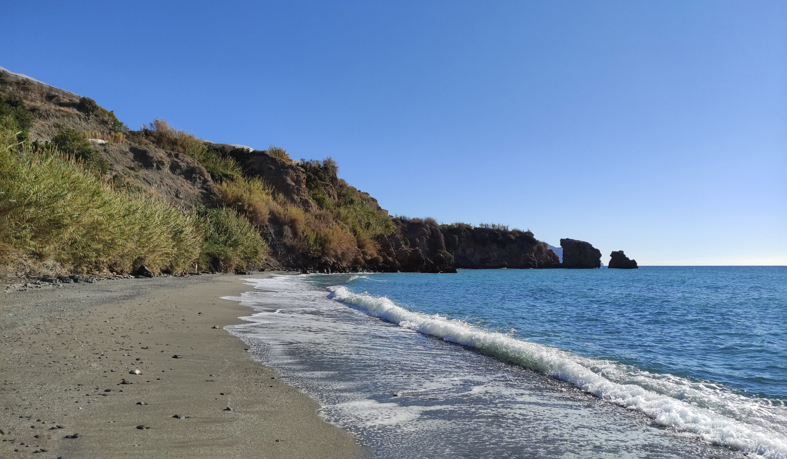
Maro is the accessible end of a chain. Immediately east is La Caleta, a small cove that Spanish visitors of a certain age will recognise from the 1981 television series Verano Azul, which was filmed around Nerja and made this coastline familiar to a whole generation. Beyond it are Cala Barranco de Maro, then Molino de Papel and Las Alberquillas, each smaller, harder to reach and correspondingly emptier.
Some can be walked to on rough cliff paths; others really are kayak-only. The rule of thumb is that every hundred metres of difficulty removes about half the people. If Maro in August feels crowded, the answer is not to go home — it is to keep going east.
Why the Snorkelling Is Better Here
Fishing is banned inside the natural park, and the difference is visible from the surface. Grouper, sponges, anemones and soft coral all turn up along the rocky margins at either end of the beach, in water calm and clear enough that no equipment beyond a mask is required to see them. On a coast where most of the accessible seabed has been fished hard for decades, this is a genuinely unusual thing to be able to say.
Divers go further along the cliffs for the caves and grottoes, which are one of the reasons the whole stretch has protected status in the first place.
The Alga Nobody Mentions
Having just told you the snorkelling here is unusually good, honesty requires the other half of the picture.
Rugulopteryx okamurae is a brown alga native to the north-west Pacific. It reached the Strait of Gibraltar in the middle of the last decade and arrived on the Granada coast at the end of 2019. Since then it has progressively colonised the seabed of this paraje, in places covering it completely — a dense brown carpet that smothers the rock, displaces the native communities and, when storms tear it loose, washes ashore in quantities that municipalities have had to remove by the lorryload.
It does not make the water dirty and it is not dangerous to swimmers. What it does is change what you see. The sponges, anemones and soft coral described above are still here and the fishing ban still means there is more fish life than on comparable unprotected coast, but on the affected sections the substrate underneath is a monoculture rather than the mosaic it was ten years ago. How much you notice depends on the season, the depth and where along the cliffs you get in.
We mention it because most guides to this coastline do not, and because arriving expecting a pristine Mediterranean seabed and finding brown carpet is the kind of surprise that sours a day. Come for the water clarity, the topography and the fish, and treat the state of the substrate as variable.
What the Protection Actually Is
The Acantilados de Maro-Cerro Gordo were declared a Paraje Natural on 18 July 1989, under the Andalusian law that established the region’s inventory of protected natural spaces. Designations have accumulated since: Special Protection Area for Birds from 2002, listing as a Specially Protected Area of Mediterranean Importance by the United Nations in 2003 under the Barcelona Convention, and Special Area of Conservation within Natura 2000 from 2015.
The shape of it matters more than the acronyms. The protected area runs from the Torre de Maro in the west to a point just south of Playa de Calahíza in the east, and extends one nautical mile out to sea. The large majority of it is water: of roughly nineteen hundred hectares, only around 384 are dry land. The cliffs reach 75 to 80 metres and drop straight to about 50 metres of depth, with the deepest point, around 71 metres, off Cerro Gordo. That is why the diving here is what it is, and why the marine rules are the ones with teeth.
Two prohibitions catch visitors out, and both apply across the whole paraje rather than beach by beach:
- Camping is prohibited throughout the protected area. There is no designated site anywhere within it.
- Overnight parking of caravans, motorhomes and similar vehicles is prohibited on all land belonging to the paraje, under a decree of 20 January 2015. This is enforced, and the access roads down to the coves are exactly where people try it.
El Cañuelo and Cantarriján, and How to Reach Them
If the advice above is to keep heading east when Maro is busy, it is worth knowing that the two beaches at the far end of that chain have a formal access system of their own, run as part of the paraje rather than by a single town hall.
Through the summer, motor-vehicle access to El Cañuelo, on the Nerja side, and Cantarriján, on the Almuñécar side, is restricted, and a shuttle service runs down to both from designated car parks at the top. The stated reasons are the usual ones and are worth taking at face value here: cutting the impact of private cars on a narrow access road, and keeping that road clear for rescue and emergency vehicles. Timetables are published season by season on the park’s own pages.
The walk down to El Cañuelo is the better half of the trip in any case. The first section has been improved under a European conservation project for threatened coastal habitats, and the descent runs through lentisc, dwarf fan palm and myrtle alongside Aleppo pine and less common species — box, Christ’s thorn, white rosemary. Cantarriján, on the far side, is a long-established naturist beach where clothed and unclothed bathers mix without anyone taking much notice.
Getting There
From Nerja, take the N-340 east towards Almería and come off at the Maro exit. Drive through the village, and shortly past the Hotel Playa Maro take the turn down a narrow road that runs between greenhouses to the coast. There is parking near the top of the access road, and a barrier marking the point beyond which vehicles are not permitted — that restriction applies whether or not the barrier happens to be up.
Roadside parking on the approach fills early in summer and the police do enforce the yellow lines. The shuttle bus is the answer, and it is more than a convenience. The Ayuntamiento de Nerja announced on 12 June 2026 that the service had entered operation and would run daily until 15 September, from 10:00 to 20:30, at a flat €3 covering both legs. The reason it matters is that private vehicles are not permitted down to the beach at all in high season: the restriction exempts public transport and emergency services, and owners or tenants of land in the area, who have to obtain authorisation from the local police first. Park in Maro and take the bus.
Map
When to Come
May, June, September and October are the sweet spots: water in the low twenties Celsius, the parking still manageable, and — in late spring — the waterfall at its best. July and August bring the warmest sea and everything else that comes with the Costa del Sol in high season. Winter is quiet and mild, with the water in the mid-teens; the cliffs and the trails are the draw rather than swimming.
If you are building a wider trip, our ranking of the best beaches in Andalucía covers the rest of the region.
Maro Village, Eating and Staying
The village above the beach is small, whitewashed and worth twenty minutes. The Balcón de Maro viewpoint beside the Iglesia de las Maravillas looks out along the coast, and the 16th-century Torre de la Marquesa watchtower stands nearby — one of the chain of towers built along this coast against Barbary raids, the same defensive logic that produced the watchtowers all the way round to Cabo de Gata.
For eating, the beach chiringuito covers a day trip; Maro village and Nerja have the range. For sleeping, Maro has guesthouses and rural rooms within walking distance of the sand, which is the option if you want the beach early, before the access road fills. Nerja, ten minutes away, has everything else.
Practical Tips
- Bring a mask. The no-fishing rule is the whole point of swimming here.
- Check the waterfall’s flow before booking a kayak trip in August.
- Park in Maro and take the €3 shuttle. You cannot drive down to the beach in high season.
- Leave nothing visible in the car on the access road.
- Walk east if it’s busy. The coves thin out fast.
- Coarse dark sand holds heat — the same shoe advice as everywhere on this coast.
General travel information, not professional or safety advice. Shuttle bus dates, parking rules and the waterfall’s flow all change from season to season — check with the Ayuntamiento de Nerja before you rely on any of them. The Acantilados de Maro-Cerro Gordo is a protected area with a fishing ban in force: take nothing out of the water.
Sources
- The protected status. Consejería de Sostenibilidad y Medio Ambiente, Junta de Andalucía — official record for the Paraje Natural Acantilados de Maro-Cerro Gordo: declaration under Ley 2/1989, Special Protection Area for Birds from 2002, ZEPIM listing by the United Nations in 2003, and Special Area of Conservation from 2015.
- The prohibitions and the shuttle service. The park’s page on the Junta’s Ventana del Visitante, which sets out the camping prohibition under Ley 2/1989 of 18 July, the ban on overnight parking of caravans and motorhomes across the whole paraje under Decreto 6/2015 of 20 January, and the summer access-regulation service with shuttle vehicles to El Cañuelo and Cantarriján. Current timetables are published on that page.
- The dimensions and the seabed. The Universidad de Granada’s Litoral de Granada project for the boundaries, the one-nautical-mile marine band, the split between land and sea area, the depth profile, and the colonisation of the seabed by Rugulopteryx okamurae since its arrival on the Granada coast at the end of 2019.
- A note on the surface area. The Junta’s visitor record gives a total of 1,844 hectares. The Universidad de Granada gives 1,913, split as 384 terrestrial and 1,529 marine. We describe it as roughly nineteen hundred hectares rather than choosing between them.
- The Maro shuttle specifically. The access-regulation service documented by the park covers El Cañuelo and Cantarriján, and is a separate thing from the shuttle down to Playa de Maro itself, which is municipal. Until August 2026 we could not source the municipal one and said so. It is now confirmed by its operator: the Ayuntamiento de Nerja announced on 12 June 2026 that the service had entered operation and would run daily to 15 September, 10:00 to 20:30, at €3 including the return leg — the same pattern as the 2025 season, which ran from 14 June. The town hall’s notice on the vehicle restriction is the source for the exemptions covering public transport, emergency services, and owners or tenants of land in the area with police authorisation. Dates are set season by season, so confirm before travelling.
Image Credits
- Header image: Playa de Maro by Por los caminos de Málaga, licensed under CC BY 2.0, via Wikimedia Commons.
- In-article image: Playa de la Caleta Maro by BjørnN, licensed under CC BY-SA 4.0, via Wikimedia Commons.
Leave a Reply